
Neighbourhood guide · V6C / V6E / V6G
Coal Harbour
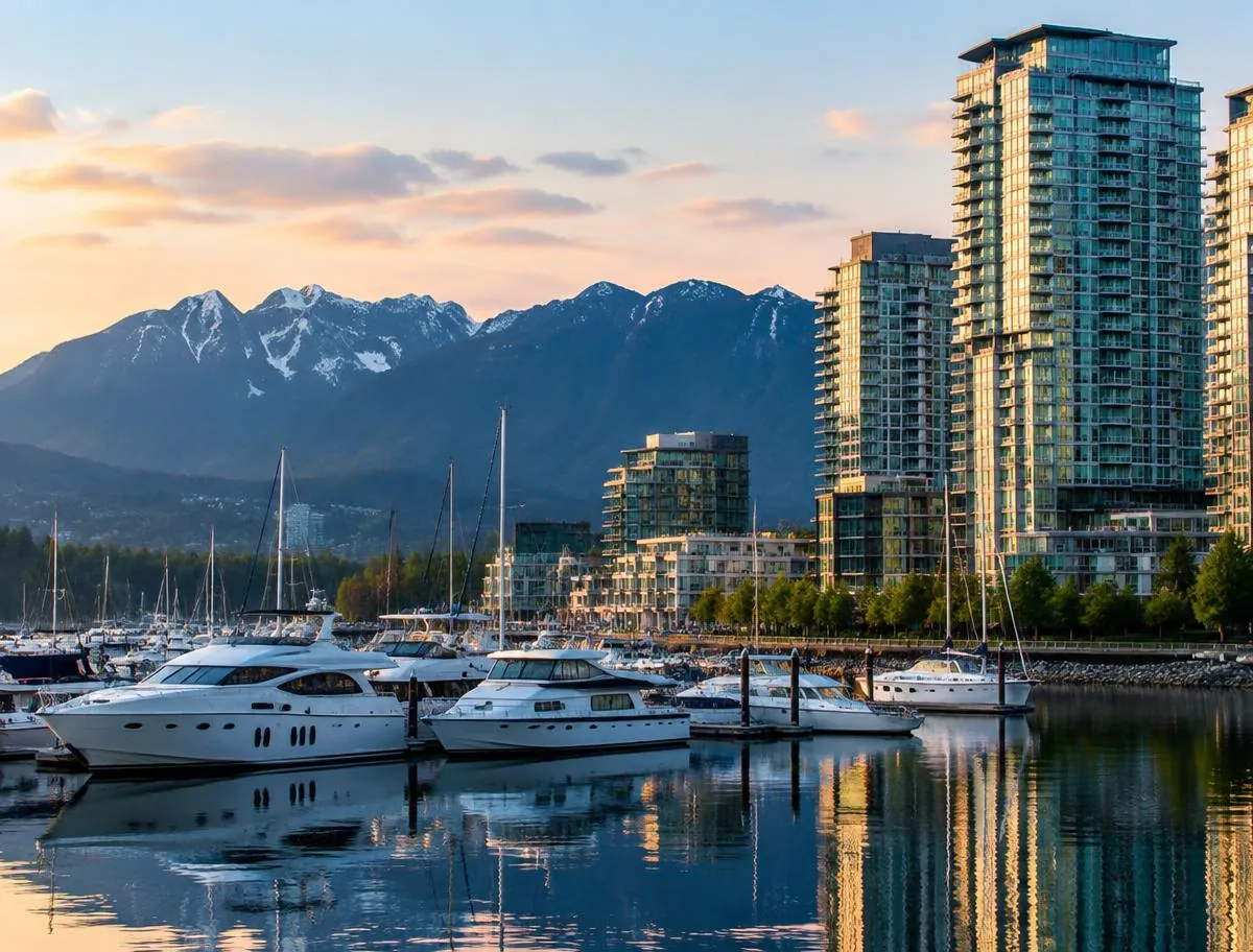
Coal Harbour lies on Burrard Inlet in Downtown Vancouver, between the office towers and Stanley Park. A Royal Navy crew found coal on its shore in 1859, rail yards and shipyards used the shore from the 1880s, and a City plan of 1990 turned it into homes and parks. This guide covers its history, its homes and their assessed values, the rules for owners, and its parks, school and transit, from public records.
Coal Harbour at a glance
Inside the boundary this page uses, Coal Harbour holds 5,312 strata lots on 39 strata plans, and 91 other titled parcels, on the City of Vancouver's 2026 tax roll.[1],[2],[3] The median BC Assessment value of a strata lot in Coal Harbour on that roll is $1,126,000, and half of them are valued between $708,000 and $1,889,500.[3] 2,359 of those strata lots, 44.4%, are in buildings BC Assessment dates to the 2000s, more than any other decade.[3] The largest strata plan in Coal Harbour is LMS4107 at 1128 W Hastings Street, with 466 strata lots.[3] From 2017 to 2026, the City issued 1,735 building permits inside Coal Harbour, 7 of them for new buildings.[4] 7 City parks lie inside Coal Harbour. The largest is Devonian Harbour Park, at 4.42 hectares.[5]
Checked Oct 24, 2026, 9:39 PM PT against City of Vancouver open data.
- Strata lots (2026 tax roll)
- 5,312[3]
- Strata plans
- 39[3]
- Median assessed value, 2026 roll
- $1,126,000[3]
- Largest strata plan
- 1128 W Hastings Street, 466 lots[3]
- SkyTrain stations inside
- Burrard[7]
- City parks inside
- 7[5]
- Heritage register sites
- 9[6]
- Building permits, 2017 to 2026
- 1,735[4]
- Coal Harbour plan adopted
- November 6, 1990 (By-law 6754)[8]
- Homes the plan allows as its base
- 2,097 dwelling units[8]
- Parks and public open space the plan requires
- 6.48 hectares, 4.19 of them neighbourhood parks[8]
- Building height limit in the plan
- 100 m; up to 137 m in the Burrard Landing precinct[8]
- Coal found on the shore
- June 12, 1859, by the crew of the Royal Navy ship Plumper[9]
- Seaside Elementary opened
- 2026 to 2027 school year[10]
- Downtown local area residents, 2016 census
- 62,030[11]
- Households renting, Downtown local area, 2016
- 57%[11]
Live from the MLS®
Homes for sale in Coal Harbour
110 homes are listed for sale in the MLS® area the board calls Coal Harbour. The newest are below.
 $1,948,000
Coal Harbour · Condo
803 - 1205 W Hastings Street
2 bed2 bath1,398 sq ft
MLS® R3185293 · Listed by Macdonald Realty
 $899,000
Coal Harbour · Condo
1903 - 1238 Melville Street
3 bed2 bath1,058 sq ft
MLS® R3185251 · Listed by Team 3000 Realty Ltd.
 $988,000
Coal Harbour · Condo
1703 - 590 Nicola Street
1 bed1 bath813 sq ft
MLS® R3185029 · Listed by RE/MAX City Realty
 $499,000
Coal Harbour · Other
1002 - 1128 W Hastings Street
1 bed1 bath361 sq ft
MLS® R3184856 · Listed by Anson Realty Ltd.
 $998,000
Coal Harbour · Condo
2206 - 1328 W Pender Street
2 bed2 bath975 sq ft
MLS® R3184543 · Listed by Sutton Group-West Coast Realty
 $548,000
Coal Harbour · Condo
1708 - 1331 W Georgia Street
1 bed1 bath537 sq ft
MLS® R3184548 · Listed by eXp Realty
See all 110 homes for sale in Coal Harbour
Listing data is supplied by Greater Vancouver REALTORS® via MLS® through RealSaige. Information is deemed reliable but not guaranteed. Each card names the brokerage that holds the listing. Prices from $499,000 among the homes shown.
MLS® data last updated Nov 22, 2026, 1:00 PM PT.
The lines this page uses
Where Coal Harbour starts and ends
The part of the City's Downtown local area west of Burrard Street and north of West Georgia Street, from the foot of Burrard Street to Stanley Park.[1]
The City of Vancouver describes Coal Harbour as stretching from Canada Place to Cardero Street along the Burrard Inlet shore, with Bayshore Gardens next to its western edge. This page takes in Bayshore too, and runs south to West Georgia Street, where the City's West End local area begins, to match the streets where homes are listed for sale as Coal Harbour.[12],[1]
Every City figure on this page counts a parcel, permit or place when the City's own map point for it lies inside this line. A home on a boundary street can sit on either side.[2]
Coal Harbour: what and where
Coal Harbour is the part of Downtown Vancouver on the south shore of Burrard Inlet, between the office towers of the business district and Stanley Park. The City of Vancouver describes it as stretching from Canada Place to Cardero Street along the shore, looking out over Stanley Park and the North Shore mountains, with Bayshore Gardens next to its western boundary. The City's area page calls Coal Harbour and Bayshore Gardens the first downtown residential neighbourhoods on Burrard Inlet.[12]
This page draws a wider line, so that its City figures cover the same streets where homes are listed for sale as Coal Harbour. It takes in the part of the City's Downtown local area west of Burrard Street and north of West Georgia Street, from the foot of Burrard Street west to Stanley Park, and it includes Bayshore. South of West Georgia Street, the City's West End local area begins.[1],[12]
Coal Harbour has no census figures of its own. The City's 22 local areas were set in the 1960s, and the City notes that they leave out newer neighbourhoods such as Coal Harbour. It lies inside the Downtown local area, so the population figures on this page are for that whole area and say so. The property, permit and park figures come from City records, counted inside the line on the map above.[11],[1],[2]
Coal Harbour through the years
1859-06-12
Francis Brockton, senior engineer of the Royal Navy survey ship Plumper, reports a vein of coal on the south shore of the inner harbour.[9]
1859-06-14
Captain George Henry Richards writes to Governor James Douglas about the coal, and names the bay Coal Harbour that year.[9],[13]
1862
Three settlers claim Lot 185, 550 acres from Burrard Street to Denman Street and from English Bay to Coal Harbour.[14]
1887
The Canadian Pacific Railway extends its line from Port Moody to Coal Harbour.[14]
1903
Vancouver Shipyards Ltd. starts building small vessels on the Coal Harbour shore.[13]
1911
The Patrick brothers build the Denman Arena, for 10,500 people, on part of the old Kanaka Ranch site.[13]
1914-05-23
The Komagata Maru anchors in Vancouver's harbour with 376 passengers, most of whom are kept on board for two months.[15]
1930
The Marine Building at 355 Burrard Street is finished, after construction began in 1929.[16]
1969
The MacMillan Bloedel Building on West Georgia Street is completed.[17]
1990-11-06
City Council adopts the Coal Harbour Official Development Plan, By-law 6754.[8]
1991-12-11
At a public hearing, Council approves the rezoning for the Marina Neighbourhood, with up to 850 homes and a marina.[18]
2004-11-08
Construction begins on the expansion of the Vancouver Convention Centre on the Coal Harbour shore.[19]
2009-04-03
The new Vancouver Convention Centre building opens, with a living roof of six acres.[20]
2011-05-25
The Vancouver Harbour Flight Centre, a seaplane terminal, opens.[21]
2022-11-24
Bill 44 ends strata bylaws that restrict long-term rentals in British Columbia.[22]
2025-11-26
The Vancouver Board of Education approves a new catchment for the Coal Harbour school.[10]
2026
The new school building on Broughton Street is completed in the summer and welcomes students for the 2026 to 2027 school year.[10]
The land, the coal and the name
The City of Vancouver sits on the unceded homelands of the Musqueam, Squamish and Tsleil-Waututh Nations, as the City states in its neighbourhood profiles. A planning document for the new school on Broughton Street, published by the Vancouver School Board, says that before Europeans arrived, the shore south of today's Coal Harbour Marina was a bluff, a steep bank, covered in thick forest down to the water. It says these waters were part of the traditional fishing grounds of the three Nations.[11],[14]
The new elementary school carries two names gifted by Nations. The Musqueam gave cəw̓as, a hən̓q̓əmin̓əm̓ name that means facing out onto the water, facing away from the shore. The Squamish Nation gave Ch’elxwá7elch Skwuláw̓txw, and the school board writes that this name connects the school to the traditional name for the area around present-day Lost Lagoon and Coal Harbour.[23]
The English name comes from coal found in 1859, when the Royal Navy survey ship Plumper was charting Burrard Inlet. On June 14, 1859, its captain, George Henry Richards, wrote to Governor James Douglas that local Indigenous reports and the rock along the shore had led him to believe coal was there. He had asked his senior engineer, Francis Brockton, to look, and on June 12 Brockton told him of a vein on the southern side of the inner harbour, a mile and a half inside the First Narrows, the narrow entrance to the harbour. Richards sent a boat, and in a few hours his crew dug over two tons, which the ship's galley burned with success.[9]
The ship's surgeon, Charles Wood, reported two seams on the beach at low water. The upper one was 4 or 5 inches thick, and the lower one grew from 7 to 15 inches thick over 7 feet, under a roof of grey sandstone with many fossil leaves. The Vancouver Historical Society's sign at Devonian Harbour Park says Richards named the bay Coal Harbour in 1859 after finding these occasional seams, and that mining the low-quality coal proved uneconomical. The Province's BC Geographical Names office records that Richards named nearby Brockton Point for the engineer in the same year, and the City of Vancouver Archives files the 1859 letters under the heading Naming of Coal Harbour.[9],[13],[24]
Settlers, shipyards and the railway, 1860s to 1980s
Settlers arrived in the 1860s. The school board's planning document records that in 1862 William Hailstone, Sam Brighouse and John Morton claimed Lot 185, which ran from Burrard Street to Denman Street and from English Bay to Coal Harbour, and were granted its 550 acres for 114 pounds sterling. In the same decade, according to the Vancouver Historical Society, several Hawaiian families settled on Coal Harbour, at a place that became known as Kanaka Ranch. They grew fruit and vegetables, fished and hunted, and sold charcoal they made on the ranch to Hastings Mill, where the men worked. Their children walked to school at the mill.[14],[13]
The Canadian Pacific Railway extended its line from Port Moody to Coal Harbour in 1887. The City's history of downtown says the first passenger train had reached the foot of Howe Street by 1887, a year after Vancouver was incorporated. The school board's document says the site of the new school was the western end of that line, and that the tracks let the area grow into an industrial district serving the marine trade, with boat builders and marine electrical and repair shops.[14],[12]
Boats and aircraft were built on the water's edge. From 1903, starting with Vancouver Shipyards Ltd., several shipyards built small vessels on the shoreline. From 1929 the Boeing Aircraft Company of Canada built flying boats there, aircraft that land on water, including models called the Thunderbird and the Totem, before switching in the 1930s to boats and household goods. On land, the Patrick brothers built the Denman Arena on part of the Kanaka Ranch site in 1911. It held 10,500 people and was home to the Vancouver Millionaires, who won the Stanley Cup in 1915, and it burned down in 1936.[13]
Much of the land under today's buildings was made by filling the harbour. The City's planning department, in guidelines for the Marina Neighbourhood from June 1995 that the school board's document quotes, says the tracks were largely in place by 1910, surrounded by lumber stored on wooden platforms and on fill. Between 1930 and 1940 the lumber area was extended into the water for a marina and a shipbuilding and repair yard. A tank farm, a group of tanks for storing fuel oil, stood north of the rail yard from 1910 to 1975, dates the guidelines give as approximate, and a shipping wharf there was demolished in 1977.[14]
The railway withdrew in the 1980s, and the land under the control of Marathon Realty was redeveloped as what the school board's document calls the Marathon Lands Project. The City's 1990 plan for Coal Harbour set out to turn a sparsely populated commercial and industrial area into a mixed neighbourhood with homes at its centre, and asked that rail and rail-ferry facilities be moved before the eastern homes and offices were built.[14],[8]
“This grassy area, now Devonian Harbour Park, represents layers of historic use from early settlement to industrial waterfront.”[13]
The Komagata Maru in the harbour, 1914
A memorial at Coal Harbour recalls the passengers of the Komagata Maru, most of whom were refused entry to Canada in 1914. The Canadian Encyclopedia records that the ship Komagata Maru left Hong Kong on April 4, 1914, and carried 376 passengers by the time it left Japan. They reached Canadian waters on May 21 and anchored in Vancouver's harbour on May 23. Canada had been turning away South Asian immigrants for the previous six years, and apart from 20 returning residents and a few special cases, no passenger was allowed ashore.[15]
The passengers stayed on board through a long standoff. The encyclopedia describes officials limiting their contact with the shore and refusing food and water except when conditions became desperate, while friends on land hired lawyers and sent supplies. After a month, both sides took a case to the British Columbia Court of Appeal, which ruled for the government. On July 23, 355 passengers left for Asia, and 321 reached Budge Budge, near Kolkata, on September 29, 1914.[15]
The Government of British Columbia apologized in May 2008, and Prime Minister Justin Trudeau apologized in the House of Commons on May 18, 2016. The City of Vancouver apologized in May 2021 and made May 23 a day of remembrance, which it renamed Guru Nanak Jahaz (Komagata Maru) Remembrance Day in 2024, when Canada Place also received that name as a second street name. The Canadian Encyclopedia says a memorial to the passengers has stood at Coal Harbour since 2012. The City's public art registry lists the Guru Nanak Jahaz (Komagata Maru) Memorial at Coal Harbour with the year 2013.[15],[25]
The heritage buildings
The Vancouver Heritage Register sorts the sites it lists into groups A, B and C. Inside this page's boundary it lists 9 sites: 6 in group A and 3 in group B. The six in group A are the Marine Building at 355 to 385 Burrard Street, the MacMillan Bloedel Building at 1075 West Georgia Street, the Banff Apartments at 1201 West Georgia Street, the Westcoast Energy building at 1333 West Georgia Street, the Stadacona Apartments at 601 Bute Street and the Evergreen Building at 1285 West Pender Street.[6]
The Marine Building was built from 1929 to 1930 to a design by the firm McCarter and Nairne. The Vancouver Heritage Foundation describes it as an example of the Art Deco style, with brick walls, Art Deco reliefs and terra cotta trim, and links it to the growth of shipping and port activity in Vancouver. The 1990 Coal Harbour plan names the Marine Building as a landmark whose views new buildings should respect.[16],[8]
The Banff Apartments, first called the Florence Court Apartments, were designed by Henry B. Watson and built from 1909 to 1910, and the Heritage Foundation calls the building a reminder that the western end of downtown was once completely residential. Its original stained glass remains at the entries and in some windows. The Stadacona Apartments at Bute Street were completed in 1912, five storeys of red brick designed by the architects Parr and Fee. The building was listed in group B and re-evaluated in 2018 into group A.[26],[27]
The other three are modern. The MacMillan Bloedel Building, designed by Erickson and Massey and completed from 1968 to 1969, has two offset 27-storey towers whose concrete walls taper from eight feet thick at the base to eight inches at the top, and it received a Massey Medal for Architecture in 1970. The Westcoast Transmission Building, which the City's register lists as Westcoast Energy, was built in 1968 and 1969. It is a 12-storey tower hung by cables from a central concrete core, and was turned into condominiums in 2005 as The Qube. On the 2026 tax roll, plan BCS1697 at 1333 West Georgia Street holds 180 strata lots. The Evergreen Building, completed in 1980, is an Erickson design on a four-sided site of uneven shape, with a diagonal sawtooth pattern.[17],[28],[29],[3]
The Coal Harbour plan of 1990
City Council adopted the Coal Harbour Official Development Plan by By-law 6754 on November 6, 1990. An official development plan is the City's top-level guide for an area: every zoning by-law, housing program, community facilities agreement and servicing agreement there must follow it, and it can change only after a public hearing. The plan's stated purpose is a neighbourhood of mixed uses centred on homes and public access to the water, designed around a north-facing site on the water, next to downtown and close to Stanley Park.[8]
The plan sets seven organizing principles. It describes the Coal Harbour basin as one of the original maritime centres of the city and asks that marine activity continue. It asks the buildings to work with the long, narrow site and keep a sense of the natural escarpment, the old bank above the shore. It wants Coal Harbour to become an integral part of downtown, with the street grid carried through to the water and a continuous walkway linking the core and Stanley Park. The others ask for streets lined with buildings, lively public places, neighbourhoods with their own identity, and planning for all ages and incomes.[8]
The site was divided into three sub-areas, each zoned on its own. Area 1, the Marina Quay Neighbourhood in the west, was planned around a marina of 350 berths (the plan calls the figure approximate), shops along Cardero Street, an elementary school, child care and a park of at least 0.8 hectares by the school. Area 2, the Harbour Green Neighbourhood, centres on a waterfront park of at least 3.2 hectares. Area 3, the Burrard Landing Precinct at the eastern end, is for hotels, offices, shops and a terminal for charter boats, visitor boats and seaplanes.[8]
The plan caps the base number of homes at 2,097 dwelling units with at most 222,939 square metres of floor area. Above that, it allows up to 13,905 square metres of market rental homes of 70 square metres or less, as an incentive, and up to 202 live/work units, which combine a home and an office. A quarter of the base homes must suit families with small children, under the City's guidelines for families in high-density housing adopted on May 30, 1989.[8]
The plan also sets 21.61% of the base homes aside for affordable housing, with priority for social housing or for core-need households: renter households who would pay 30% or more of their gross income for an average market rental home. Half of these homes must suit families with small children, and they must be spread through each residential area. A City report of November 28, 1995, records that Council approved the rezoning for Marathon's Marina Neighbourhood at a public hearing on December 11, 1991, with up to 850 homes, commercial space and a marina, and 122 core-need homes. The report proposed replacing them with 99 non-market family homes and lowering the limit to 827 homes.[8],[18]
The developer had to build the shoreline and walkway before the first permanent building next to them was occupied. The plan limits land, old and new, to half the site or 16.6 hectares, with the rest kept as water. It required a plan to clean up the soil, approved by the provincial Ministry of Environment, sound insulation for homes near seaplanes, rail yards and busy roads, and half the cost of up to two saltwater pumping stations, which the plan requires for earthquake preparedness.[8]
How the towers were shaped
Under the plan, no building may rise above 100 metres, apart from roof features with no living space. Heights must vary, step back from the shore, and rise toward the eastern end. The Harbour Green precinct may go up to 10% higher, and the Burrard Landing precinct up to 137 metres, if a building improves views, shadows, privacy, open spaces or its fit with neighbours. Office buildings on the lower level between Thurlow and Burrard streets are capped at 30 metres or 6 storeys, whichever is less, to match the older buildings beside them.[8]
Any building taller than 35 metres must face a set direction. From Cardero to Jervis it follows the downtown street grid; from Jervis to Thurlow it follows the curve of the shore and the park; and from Thurlow to Burrard it follows the nearby downtown grids. Residential towers must be point towers, slim towers with a small floor on each level, and the plan's guide for the largest residential floor above a building's base is 570 square metres. Office towers may have larger floors but must look less bulky as they rise.[8]
Every view north along the existing downtown streets to the water and mountains must stay open, and the plan measures each view corridor as at least 5 degrees on each side of the extended street, from points it names for Burrard, Thurlow, Bute, Jervis, Broughton, Nicola and Cardero streets. Views from Portal Park are protected, some wide views must stay open to at least 45 degrees, and new buildings should respect views of the Marine Building and the sails of Canada Place.[8]
Within each area the plan asks for lower buildings near the water and taller ones behind. In Harbour Green, lower homes line the park and taller, widely spaced towers stand along the extension of Cordova Street. In the Marina area, lower homes with shops face the water and Cardero Street. When the City's area page was written, it described Coal Harbour as under way with 1.5 million square feet of office, shop and hotel space and housing for an estimated 3,500 people. For Bayshore Gardens, the 9-hectare site to the west, it described a planned population of 1,400, an expanded Bayshore Hotel, a 250-berth marina, a park, a daycare and a waterfront path to Stanley Park.[8],[12]
Marinas, seaplanes and the working harbour
The plan asks that a range of water uses continue on the harbour, and that some of the small marine businesses that give the waterfront its character stay. Covered boatsheds and floating offices had to go within three years of each sub-area's zoning, except those needed for temporary use by repair businesses or by the Vancouver Police Marine Squad. The owner had to lease the police a piece of water for two boat berths, of at least 150 square metres, at no cost to the City.[8]
The plan defines a floating home as a floating building or vessel used mainly as a home and relying on services on shore, and a liveaboard as a boat used mainly for travel on the water that someone also lives on. Floating homes are discouraged and limited to 10% of marina berths. Marinas may hold up to 200 liveaboards, if they meet the zoning, City servicing rules and add no load on community facilities. Every berth should have a sewage pump-out connection, some space must be kept for visitors, the public must have access except where boats need security, and people should be able to launch small boats by hand.[8]
The plan required a marine terminal at the eastern end of the water area for charter boats, visiting boats and seaplanes. The Vancouver Harbour Flight Centre, a seaplane terminal, opened on May 25, 2011, at a cost CTV News gave as $18.5 million. Harbour Air says its downtown terminal is inside the Flight Centre, in Coal Harbour near Canada Place, the convention centre and Jack Poole Plaza. CTV reported that 300,000 passengers fly out of Vancouver Harbour each year to places around British Columbia, and that before the terminal opened, seaplane companies had worked from a temporary terminal in Coal Harbour for seven years.[8],[21],[30]
Burrard Landing and the convention centre
The eastern end of Coal Harbour, between Burrard and Thurlow streets, was planned as the commercial part of the neighbourhood. The plan allows up to 139,500 square metres of offices there. Hotels may exceed 37,000 square metres only if office space drops by the same amount, and offices and hotels together are capped at 176,500 square metres. It also allowed a convention and exhibition centre, with up to 23,225 square metres more for an exhibition hall, and asked for a major public building for cultural and recreation use on the waterfront.[8]
Canada Place was built as Canada's pavilion at Expo 86 and is the city's cruise ship terminal, according to the City. On November 8, 2004, the Government of Canada announced that construction had begun on a $565 million expansion of the convention centre. Tourism Vancouver was to give $90 million, the federal and provincial governments up to $222.5 million each, and the centre's own revenue $30 million. The expansion was to more than triple the centre's space and serve as the broadcast centre for the 2010 Olympic and Paralympic Winter Games.[12],[19]
The new building opened on April 3, 2009. The Province's release that day, published on the convention centre's website, put the cost at $883.2 million, funded by the Province ($540.7 million), the Government of Canada ($222.5 million), Tourism Vancouver ($90 million) and $30 million in revenue from the centre. It describes 111,500 square metres of added space, 52 meeting rooms, a six-acre living roof, which is a roof covered in plants, and a 90-metre glass link to the original centre at Canada Place. The two releases give different totals: $565 million when work began in 2004 and $883.2 million at the opening in 2009.[20],[19]
The City's public art registry lists the sculpture Digital Orca, from 2009, at Jack Poole Plaza at the Vancouver Convention Centre. In all, the registry lists 32 works in place inside this page's boundary: 16 sculptures, 8 works built into a site, 3 fountains or water features, 2 reliefs, 1 figure, 1 media work and 1 memorial. Among the newest are the B6 Public Art Screen from 2024 and the sculpture Spirit of Our Ancestors On The Land from 2023.[25]
The homes in Coal Harbour today
Inside the boundary on this page, the City's 2026 tax roll lists 5,312 strata lots on 39 strata plans, and 91 other titled parcels. A strata lot is a unit with its own title, and a strata plan is the registered plan that divides a building or group of buildings into strata lots. A strata lot can be a home, a commercial unit or another titled space.[3],[2]
Plan LMS4107 at 1128 West Hastings Street has 466 strata lots in a building BC Assessment dates to 1999, with a median assessed value of $412,100 on the 2026 roll. Plan LMS2064 at 588 Broughton Street has 382 strata lots from 1995, with a median of $711,000. Plan BCS535 at 499 Broughton Street has 248 strata lots from 2003, with a median of $1,508,000, and plan BCS3699 at 1011 West Cordova Street has 175 strata lots from 2010, with a median of $3,360,000.[3]
Most of Coal Harbour's strata lots are in buildings from two decades. BC Assessment's year built puts 2,359 strata lots, on 21 plans, in buildings from the 2000s and 2,201 strata lots, on 11 plans, in buildings from the 1990s. The 2010s added 629 strata lots on 5 plans, and one plan from the 2020s holds 118. Plan EPS2884 at 1151 West Georgia Street, from 2016, is the largest of the newer ones, with 217 strata lots and a median assessed value of $1,700,500.[3]
Most buildings sit on CD-1 zoning, a zone written for one site or group of sites, which is how the City carried out the 1990 plan one sub-area at a time. On the 2026 roll, the largest single zone is the Downtown District, with 1,251 strata lots. Plan BCS2321 at 1189 Melville Street, from 2007, holds 240 of them. The largest CD-1 zones are CD-1 (409) with 505 strata lots and CD-1 (321) with 499.[3],[8]
Assessed values, 2016 to 2026
BC Assessment values every property in the province at its market value on July 1, and the roll shows each property's physical condition and zoning on October 31. Notices are mailed on December 31, and an owner who wants an independent review must file a complaint by January 31. So each year's City tax roll shows values set the July before. These are values for property tax, and a home can sell above or below them.[31],[3]
Across the strata lots inside this page's boundary, the median assessed value was $810,000 on the 2016 roll and $1,093,000 on the 2017 roll. It reached $1,347,000 on the 2019 roll, the highest median in the table below, and was $1,197,000 on the 2020 roll and $1,256,000 on the 2023 roll. On the 2026 roll it stands at $1,126,000. A quarter of Coal Harbour's strata lots are valued below $708,000 on that roll, and a quarter above $1,889,500.[3]
The count of strata lots changes over the years, from 5,182 strata lots on the 2016 roll to 5,312 on the 2026 roll, so each year's median describes a different set of units. Earlier years count only land parcels that carry the same land coordinate today, so a tower on a newer parcel joins the count in the year its strata lots first appear. And the median includes commercial strata lots, among them the 466 strata lots on plan LMS4107, whose median is $412,100. The building guides on this site show one building's values year by year.[3]
Renting, short stays and taxes for owners
In the 2016 census, 57% of households in the City's Downtown local area rented their home, compared with 53% across Vancouver, and 19% of rented homes Downtown were subsidized housing, compared with 14% across the city. These figures cover the whole Downtown local area, which includes Coal Harbour, Yaletown and the business district.[11]
Since November 24, 2022, a strata corporation in British Columbia can no longer restrict owners from renting out their homes on long-term tenancies. Bill 44, the Building and Strata Statutes Amendment Act, 2022, removed that power and ended age limits in strata bylaws, apart from a bylaw that requires residents to be at least 55. The law firm Blakes notes that a strata can no longer screen tenants, set screening criteria or require approval of a tenant, and that strata corporations can still pass bylaws restricting vacation and other short-term stays.[22]
A stay of less than 90 days in a row needs a City of Vancouver short-term rental licence. The home must be the host's principal residence, each person may hold one licence, and the strata or landlord must approve before the host applies. The licence costs $1,108 a year plus a $77 application fee. Vancouver is also on the Province's list of places where short-term rentals are limited to the host's principal residence plus one secondary suite or extra home on the same property.[32],[33]
Two taxes apply to homes left empty. The City's Empty Homes Tax, started in 2017, requires every Vancouver homeowner to make a declaration each year that decides whether the home is subject to the tax. A home deemed or declared empty in 2025 pays 3% of its 2025 assessed taxable value, and the declaration for 2025 was due on February 3, 2026. The Province's Speculation and Vacancy Tax is a separate annual tax based on how owners use residential property in the areas it covers, and owners there must declare every year by March 31.[34],[35]
New buildings since 2017
From 2017 to 2026, the City issued 1,735 building permits inside Coal Harbour. Of these, 1,665 were additions or alterations to existing buildings, 48 were for temporary buildings or structures, 8 for demolition, 6 for salvage and the removal of hazardous materials, 7 for new buildings and 1 for an outdoor use. The seven new building permits carry declared values of $844,473,557 in all. The busiest years were 2017, with 243 permits, and 2018, with 242.[4]
Three of the six are tall buildings with offices. At 1090 West Pender Street, a permit issued on September 20, 2019, allows a 32-storey office tower with 7 storeys below ground, shops and rooms for gatherings on the first floor and offices above, at a declared value of $185,000,000. A permit of December 12, 2019, for 1133 Melville Street covers a 38-storey building with offices, a fitness centre, restaurants and parking, at $240,000,000. The third, at 1166 West Pender Street, dates from March 13, 2023: a 32-storey building with offices and restaurants, at $154,750,000.[4]
The others add homes. At 620 Cardero Street, a permit from February 2, 2017, allows two levels of shops, four levels of business and personal services and twenty-one levels of homes. On West Hastings Street, number 1250 received a permit on July 12, 2018, for a 19-storey building with a shop on the second floor, 20 homes from the third to the 19th floors and three levels of underground parking. Last came 488 Broughton Street, with a permit of September 2, 2022, for an 11-storey building with a child day care, homes and an elementary school, at a declared value of $69,723,557.[4]
That permit lists the same three uses as the building that a planning document from January 2021, prepared for the City and the school board, calls Coal Harbour Phase 2, the last parcel of the Coal Harbour master plan. It describes a 340-student elementary school, a childcare centre for 65 children aged up to 5, and 60 social housing homes with a focus on larger family homes, built to Passive House standards for low energy use. The City was the project manager and sponsor of the childcare and the housing, and the school board sponsored the school. The document says the design follows a preliminary development permit from 1998 and connects to the Coal Harbour Community Centre and Coal Harbour Park, built in Phase 1.[14],[4]
Getting around
Burrard station on the Expo Line sits inside the neighbourhood, 568 metres in a straight line from its centre. Expo Line trains run from Waterfront station to King George station in Surrey and to Production Way station, according to TransLink. On December 11, 2025, TransLink marked 40 years of SkyTrain, which it says began with 21 kilometres of track and has grown to four times that size.[7],[36],[37]
Waterfront station is 939 metres from the centre of Coal Harbour in a straight line. It is the downtown end of the Expo Line and of the Canada Line to the airport and Richmond. The SeaBus leaves Waterfront for Lonsdale Quay in North Vancouver every 15 minutes during the day, seats up to 395 passengers and takes 12 minutes to cross the inlet. The West Coast Express commuter train runs on weekdays between Waterfront and Mission City, west in the morning and east in the evening. Granville station is 921 metres away and Vancouver City Centre station 999 metres. Walking routes are longer than these straight lines.[7],[36],[38],[39]
The 1990 plan reserves a right-of-way through Coal Harbour for a public transit line linking downtown centres, asks that bus routes be set by the City and the transit authority as people move in, and asked that passenger ferries along the waterfront be considered. It also called for bicycle routes and a walkway along the water, and asks that traffic be designed to bring visitors in while keeping commuters from cutting through.[8]
In the 2016 census, two-thirds of commuters living in the Downtown local area got to work without a car, and Downtown residents were more than three times as likely as other Vancouver residents to walk to work. More than two-thirds of Downtown workers took under half an hour to get to work.[11]
Parks and the seawall
The City lists 7 parks inside Coal Harbour. Devonian Harbour Park, at 4.42 hectares, is the largest, followed by Harbour Green Park at 3.1 hectares and Coal Harbour Park at 0.95 hectares. The others are Marina Square, Cardero Park, Portal Park and Art Phillips Park. The 1990 plan requires at least 6.48 hectares of parks and public open space, 4.19 hectares of it for neighbourhood parks, built by the owner at no cost to the City, and a continuous waterfront walk at least 7.6 metres wide, with buildings set back at least 7.6 metres from it.[5],[8]
The City's park records list the seawall as a feature of Harbour Green Park, Cardero Park, Marina Square and Devonian Harbour Park. Harbour Green Park, at 1199 West Cordova Street, has washrooms, a spray park and a restaurant. Coal Harbour Park, at 480 Broughton Street, holds the community centre. Devonian Harbour Park, at the west end by Georgia and Denman streets, has a dog off-leash area open from 6 in the morning to 10 at night. The plan asked for at least 3.2 hectares at Harbour Green and 0.8 hectares by the school, a figure it calls approximate, and the City's current park records give 3.1 and 0.95 hectares.[40],[5],[41],[8]
The seawall along Coal Harbour is part of a 28-kilometre path that the City describes as running from the Vancouver Convention Centre to Spanish Banks Park, with one lane for walkers and joggers next to the water and one for cyclists and inline skaters. Work on the seawall began in Stanley Park in 1917, the loop around the park was declared complete on September 21, 1980, and the wall has been extended outside the park since then. The City gives the 9-kilometre loop around Stanley Park as 2 to 3 hours on foot or 1 hour by bike.[42]
The Vancouver Historical Society put up a sign in Devonian Harbour Park in 2008, along the Georgia Street sidewalk, that tells of the coal seams, Kanaka Ranch, the Denman Arena and the shipyards on this ground. The sign also records the Georgia Auditorium, which Frank Patrick built beside the arena in 1927 for boxing, wrestling, rallies and shows, and which was demolished seven years after it took that name in 1952.[13]
The new school, childcare and the community centre
Coal Harbour now has a public elementary school inside its boundary. The Vancouver School Board writes that the building for cəw̓as Ch’elxwá7elch Skwuláw̓txw Seaside Elementary, at 482 Broughton Street, was completed in the summer of 2026 and welcomed students for the 2026 to 2027 school year. Until the building opened, its students were taught at Lord Roberts Elementary and the Lord Roberts Annex. The City's school data used for the table on this page lists no school inside the boundary yet, and gives Lord Roberts Annex as the nearest, 872 metres away in a straight line.[10],[23],[43]
On November 26, 2025, the Board of Education approved new catchment lines for Lord Roberts, Elsie Roy and Crosstown elementary schools and created a catchment for the new school. The board says it weighed school capacity, the water around the peninsula, walking routes, neighbourhoods and road safety, and that enrolment downtown keeps exceeding operating capacity. Downtown now has four elementary schools and one secondary school, King George, 876 metres from the centre of Coal Harbour. The school a child attends depends on the catchment for the home's address, so families should check it for each home.[10],[43]
The Coal Harbour Community Centre at 480 Broughton Street sits on the seawall near Stanley Park. The City lists multi-purpose rooms, a dance studio, a gymnasium, a playground, childcare for school-age children and an occasional care preschool program. The Vancouver Park Board and the West End Community Centre Association run it jointly, as they do the West End Community Centre, 850 metres away. The 1990 plan required four day care facilities, a community centre and a room for family programs and a public health centre. The owner had to provide the day cares, the family room and a finished 750 square metres of the community centre at no cost to the City.[44],[45],[8]
The City's library data lists no branch inside the boundary. The 1990 plan required the owner to pay the City for library needs, to be spent on facilities in the West End or at the main branch. The Joe Fortes branch on Denman Street is 850 metres from the centre of Coal Harbour in a straight line, and the Central Branch on West Georgia Street is 1,319 metres away.[8],[46]
Who lives in the Downtown local area
The most recent City profile of the Downtown local area uses the 2016 census, which counted 62,030 residents on 3.8 square kilometres, more than seven thousand more than in 2011. Downtown's population density was 162 people per hectare, three times the density of the city as a whole, and from 1996 to 2016 its population grew by 256%. Coal Harbour is one part of that area, and the City has no separate count for it.[11]
Households Downtown are small. In 2016 the average private household held 1.7 people, compared with 2.2 across the city, and 31% of residents lived alone, compared with 18% across the city. A majority of homes Downtown had one bedroom or fewer. In the year before the census, 25% of Downtown residents had moved, and over five years 64% had moved.[11]
The City counts 69% more seniors, aged 65 and older, than children aged 14 and under in the Downtown local area. From 1996 to 2016 the number of children there grew by 590% and the number of seniors by 276%. In 2016, 37% of Downtown seniors lived alone, and 38% of households led by seniors rented their home, a lower share than for Downtown households as a whole.[11]
BC Assessment, City of Vancouver tax roll
Assessed values in Coal Harbour by year
| Tax roll | Strata lots | Lower quarter | Median | Upper quarter |
|---|---|---|---|---|
| 2026 | 5,312 | $708,000 | $1,126,000 | $1,889,500 |
| 2025 | 5,312 | $758,000 | $1,177,000 | $2,015,000 |
| 2024 | 5,311 | $773,250 | $1,203,000 | $2,105,750 |
| 2023 | 5,310 | $777,250 | $1,256,000 | $2,197,500 |
| 2022 | 5,302 | $752,250 | $1,225,000 | $2,193,750 |
| 2021 | 5,302 | $732,000 | $1,177,000 | $2,095,750 |
| 2020 | 5,302 | $710,000 | $1,197,000 | $2,093,000 |
| 2019 | 5,183 | $783,000 | $1,347,000 | $2,367,250 |
| 2018 | 5,183 | $744,000 | $1,256,000 | $2,282,000 |
| 2017 | 5,182 | $651,000 | $1,093,000 | $2,010,000 |
| 2016 | 5,182 | $474,000 | $810,000 | $1,509,000 |
A quarter of the strata lots are valued below the lower quarter figure, and a quarter above the upper one. BC Assessment values as published in the City of Vancouver tax roll, for property tax. A strata lot can be a home, a commercial unit or another titled space. Earlier years count only the land parcels that still carry the same land coordinate today, so towers on newer parcels join the count in the year their strata lots first appear. The City says legal descriptions in this data are not definitive. Retrieved Oct 24, 2026, 9:39 PM PT.[3]
BC Assessment year built
When Coal Harbour's strata buildings were built
| Decade built | Strata plans | Strata lots | Share of lots |
|---|---|---|---|
| 1990s | 11 | 2,201 | 41.4% |
| 2000s | 21 | 2,359 | 44.4% |
| 2010s | 5 | 629 | 11.8% |
| 2020s | 1 | 118 | 2.2% |
| Not given | 1 | 5 | 0.1% |
Each strata plan is dated by the median year built BC Assessment gives its strata lots on the 2026 roll. BC Assessment sets year built from permit records, so a converted heritage building can carry its original year.[3]
2026 tax roll
The largest strata buildings in Coal Harbour
| Address | Plan | Strata lots | Built | Median value |
|---|---|---|---|---|
| 1128 W Hastings Street | LMS4107 | 466 | 1999 | $412,100 |
| 588 Broughton Street | LMS2064 | 382 | 1995 | $711,000 |
| 1239 W Georgia Street | LMS3963 | 264 | 1999 | $715,000 |
| 499 Broughton Street | BCS535 | 248 | 2003 | $1,508,000 |
| 1189 Melville Street | BCS2321 | 240 | 2007 | $846,000 |
| 1151 W Georgia Street | EPS2884 | 217 | 2016 | $1,700,500 |
| 1328 W Pender Street | BCS460 | 212 | 2003 | $1,047,000 |
| 1331 W Georgia Street | LMS2728 | 208 | 1997 | $654,000 |
| 1238 Melville Street | LMS2080 | 196 | 1995 | $869,000 |
| 1211 Melville Street | BCS3053 | 192 | 2008 | $1,009,000 |
| 1333 W Georgia Street | BCS1697 | 180 | 2006 | $619,500 |
| 1011 W Cordova Street | BCS3699 | 175 | 2010 | $3,360,000 |
One strata plan can cover more than one street address, and the address shown is one of them. A strata lot can be a home or a commercial unit.[3]
City of Vancouver, 2017 to 2026
New buildings since 2017
The City issued 1,735 building permits inside Coal Harbour from 2017 to 2026. Addition / Alteration: 1,665. Temporary Building / Structure: 48. Demolition / Deconstruction: 8. New Building: 7. Salvage and Abatement: 6. Outdoor Uses (No Buildings Proposed): 1.[4]
By year: 2017: 243 · 2018: 242 · 2019: 190 · 2020: 120 · 2021: 147 · 2022: 161 · 2023: 161 · 2024: 174 · 2025: 168 · 2026: 129
2023-07-05 · 1688 W Georgia Street · $100,000,000 · BP-2022-03440
This permit was further extended until May 8th, 2026. The 16 weeks - extension was authorized by Saul Schwebs via Corrie Okell; see email correspondence in docs. 14/Jan/2026 tn.
2023-03-13 · 1166 W Pender Street · $154,750,000 · BP-2022-02756
To construct a 32-storey (34-storey Z&D) mixed-use building
2022-09-02 · 488 Broughton Street · $69,723,557 · BP-2021-02939
To construct a new 11-storey, mixed-use building
2019-12-12 · 1133 Melville Street · $240,000,000 · BP-2018-02682
To construct a 38 storey mixed -use building (37 Level building)
2019-09-20 · 1090 W Pender Street · $185,000,000 · BP-2018-04381
To construct new 32 storey office tower with 7 storeys below grade. Commercial retail and assembly suites on the first storey, and offices on the above grade levels.
2018-07-12 · 1250 W Hastings Street · $30,000,000 · BP-2017-00485
Construction of a new 19 storey building with Retail Store on the second floor, 20 dwelling units on the 3rd through 19th floors, and 3 levels of underground parking accessed from West Hastings Street.
2017-02-02 · 620 Cardero Street · $65,000,000 · BP-2016-02588
Construction of a mixed-used development consisting of the following: two levels of commercial retail units with ground-level entrances, four levels of business and personal services, and twenty-one levels of residential dwelling units.
Values are the construction values declared on each permit. A large project can be issued in stages, each with its own permit.
City of Vancouver open data
Parks, schools and services in Coal Harbour
Parks[5]
- Devonian Harbour Park · 4.42 haInside
- Harbour Green Park · 3.1 haInside
- Coal Harbour Park · 0.95 haInside
- Marina Square · 0.63 haInside
- Cardero Park · 0.33 haInside
- Portal Park · 0.1 haInside
- Art Phillips Park · 0.1 haInside
SkyTrain stations[7]
- BurrardInside
- Granville922 m
- Waterfront941 m
- Vancouver City Center1,000 m
Schools[43]
- Lord Roberts Annex · Public School870 m
- King George Secondary · Public School873 m
Community centres[45]
- Coal HarbourInside
- West End848 m
Libraries[46]
- Joe Fortes848 m
Dog off-leash areas[41]
- Devonian Harbour · 6 AM to 10 PMInside
- Nelson Park · 7 AM to 9 PM898 m
"Inside" means the City's map point for the place lies inside the boundary above. Other distances are straight lines from the centre of the neighbourhood, measured Oct 24, 2026, 9:39 PM PT. Walking routes are longer, and a school's catchment decides who attends it.
City of Vancouver open data
Heritage register and public art
The Vancouver Heritage Register lists 9 sites inside Coal Harbour: 6 in evaluation group A, 3 in group B and 0 in group C. 3 are protected by municipal heritage designation.[6]
Group A sites: Evergreen Building, 1285 W PENDER ST; Westcoast Energy, 1333 W GEORGIA ST; Stadacona Apartments, 601 BUTE ST; Banff Apartments, 1201 W GEORGIA ST; MacMillan Bloedel Building, 1075 W GEORGIA ST; Marine Building, 355-385 BURRARD ST.[6]
The City's public art registry lists 32 works in place inside Coal Harbour. The most recent include B6 Public Art Screen (2024), Spirit of Our Ancestors On The Land (2023), Landscape: Possessing Numerous Peaks and Ripples (2016), Nike (2014).[25]
Building guides in Coal Harbour
Questions about Coal Harbour
Why is it called Coal Harbour?
Coal Harbour is named for coal found on its south shore in June 1859 by the crew of the Royal Navy survey ship Plumper. The ship's engineer, Francis Brockton, reported a vein on June 12, and Captain George Henry Richards wrote to the governor two days later. The Vancouver Historical Society says Richards named the bay that year, and that mining the low-quality coal proved uneconomical.[9],[13]
Where are the boundaries of Coal Harbour?
The City of Vancouver describes Coal Harbour as stretching from Canada Place to Cardero Street along the Burrard Inlet shore, with Bayshore Gardens next to its western boundary. Homes listed for sale as Coal Harbour cover a wider area, so this guide counts the part of the Downtown local area west of Burrard Street and north of West Georgia Street, out to Stanley Park, as shown on the map.[12],[1]
What was Coal Harbour before the condos?
Coal Harbour was railway and industrial land from the 1880s until the 1980s. The Canadian Pacific Railway reached it from Port Moody in 1887, and shipyards built small vessels on the shore from 1903, with flying boats built there from 1929. Much of the land was made by filling the harbour for tracks, lumber storage, a marina, shipyards and fuel oil tanks.[14],[13]
Who developed the Coal Harbour waterfront?
Much of the Coal Harbour waterfront was railway land. After the Canadian Pacific Railway withdrew in the 1980s, the land under the control of Marathon Realty was redeveloped, according to a school board planning document. A City report records that Council approved the rezoning for Marathon's Marina Neighbourhood on December 11, 1991, under the Coal Harbour plan adopted on November 6, 1990. Each building guide on this site names that building's developer where public records show it.[14],[18],[8]
How tall can buildings be in Coal Harbour?
The Coal Harbour plan limits buildings to 100 metres, with up to 10% more in the Harbour Green precinct and up to 137 metres in the Burrard Landing precinct at the east end, where a building improves views, shadows or privacy. Residential towers must be slim point towers, and buildings step down toward the water and toward the west.[8]
What did the Coal Harbour plan require the developer to build?
The 1990 Coal Harbour plan required at least 6.48 hectares of parks and open space, a waterfront walk at least 7.6 metres wide, the shoreline itself, a site for an elementary school, part of a community centre, four day care facilities and a room for family programs. It also required a payment for library services and half the cost of up to two saltwater pumping stations.[8]
Is there a school in Coal Harbour?
Yes. cəw̓as Ch’elxwá7elch Skwuláw̓txw Seaside Elementary, at 482 Broughton Street in Coal Harbour, welcomed students for the 2026 to 2027 school year after its building was completed in the summer of 2026. The Vancouver School Board created its catchment on November 26, 2025. Check the catchment for each home's address, because it decides the school a child attends.[10],[23]
What does the Coal Harbour school's name mean?
The Coal Harbour school has two names gifted by Nations. cəw̓as, from the Musqueam, is a hən̓q̓əmin̓əm̓ name meaning facing out onto the water, facing away from the shore. Ch’elxwá7elch Skwuláw̓txw, from the Squamish Nation, connects the school to the traditional name for the area around Lost Lagoon and Coal Harbour, according to the Vancouver School Board. Its English name is Seaside Elementary.[23]
Can a strata in Coal Harbour stop me renting out my condo?
A Coal Harbour strata cannot restrict long-term rentals. Since November 24, 2022, Bill 44 has stopped every strata corporation in British Columbia from restricting owners from renting on long-term tenancies or screening tenants. A strata can still pass bylaws that restrict short-term and vacation rentals, and it may keep or pass a bylaw that requires residents to be 55 or older.[22]
Can I rent my Coal Harbour condo on Airbnb?
Only if the Coal Harbour home is your principal residence and you hold a City of Vancouver short-term rental licence. Stays under 90 days in a row need the licence, which costs $1,108 a year plus a $77 application fee. Your strata or landlord must approve before you apply, and each person may hold one licence. The Province's principal residence rule also covers Vancouver.[32],[33]
Do Coal Harbour condo owners pay the Empty Homes Tax?
Every owner of a Coal Harbour home must make a yearly declaration for the City of Vancouver's Empty Homes Tax, which started in 2017. A home deemed or declared empty in 2025 pays 3% of its 2025 assessed taxable value. The Province's Speculation and Vacancy Tax needs its own yearly declaration by March 31.[34],[35]
When are BC Assessment values for Coal Harbour condos set?
BC Assessment values each Coal Harbour condo at its market value on July 1 of the year before the tax roll, using the home's condition and zoning on October 31. Notices are mailed on December 31, and an owner who wants an independent review must file a complaint by January 31. The values on this page come from the City of Vancouver's tax roll, which publishes those figures.[31],[3]
How do I get from Coal Harbour to North Vancouver?
From Coal Harbour, walk or take the Expo Line from Burrard station to Waterfront station, 939 metres from the centre of the neighbourhood in a straight line, and board the SeaBus to Lonsdale Quay. TransLink says the SeaBus leaves every 15 minutes during the day, seats up to 395 passengers and crosses the inlet in 12 minutes.[7],[38],[36]
Can I take a seaplane from Coal Harbour?
Yes. Harbour Air says its downtown seaplane terminal is in Coal Harbour, inside the Vancouver Harbour Flight Centre near Canada Place and the convention centre. The Flight Centre opened on May 25, 2011, and CTV News reported then that 300,000 passengers fly out of Vancouver Harbour each year to places around British Columbia. The 1990 Coal Harbour plan required a seaplane terminal at the eastern end of the water.[30],[21],[8]
Is there a dog park in Coal Harbour?
Yes. The City of Vancouver lists a dog off-leash area in Devonian Harbour Park, at the west end of Coal Harbour by Georgia and Denman streets, open from 6 in the morning to 10 at night. The next nearest, at Nelson Park in the West End, is open from 7 in the morning to 9 at night. Check the posted hours before you go.[41],[40]
How many people live in Coal Harbour?
No official count exists for Coal Harbour alone. The City's local areas were set in the 1960s and leave out newer neighbourhoods such as Coal Harbour, which lies inside the Downtown local area. In the 2016 census, the Downtown local area had 62,030 residents on 3.8 square kilometres, with 1.7 people in the average household. Coal Harbour holds 5,312 strata lots on the 2026 tax roll.[11],[3]
What is the Komagata Maru memorial in Coal Harbour?
The memorial in Coal Harbour honours the 376 passengers of the Komagata Maru, a ship that anchored in Vancouver's harbour on May 23, 1914. Most were kept on board for two months and then sent back to Asia. The Canadian Encyclopedia dates the memorial to 2012, and the City's public art registry lists it with the year 2013.[15],[25]
Can I keep a boat or live aboard in Coal Harbour?
The Coal Harbour plan allows marinas with up to 200 liveaboards, boats used mainly for travel that someone also lives on, if they meet the zoning and City servicing rules. Floating homes are discouraged and limited to 10% of berths. The exact number of berths and liveaboards at each marina was set when that part of Coal Harbour was zoned.[8]
How many condos are there in Coal Harbour?
The City of Vancouver's 2026 tax roll lists 5,312 strata lots on 39 strata plans inside the Coal Harbour boundary this page uses. A strata lot is a unit with its own title, so the count can include commercial strata units as well as homes. A building on a single title counts as one parcel.[3],[1]
What is the median assessed value of a condo in Coal Harbour?
On the 2026 tax roll, the median BC Assessment value of the strata lots in Coal Harbour is $1,126,000. A quarter are valued below $708,000 and a quarter above $1,889,500. These are BC Assessment values for property tax. A sale price can be higher or lower.[3]
Which SkyTrain stations are in or near Coal Harbour?
Burrard station is inside Coal Harbour. Measured in a straight line from the centre of the neighbourhood, the nearest stations are Burrard (569 m), Granville (922 m) and Waterfront (941 m). Walking routes are longer.[7]
What parks are in Coal Harbour?
The City lists 7 parks inside Coal Harbour: Devonian Harbour Park (4.42 ha), Harbour Green Park (3.1 ha), Coal Harbour Park (0.95 ha), Marina Square (0.63 ha), Cardero Park (0.33 ha), Portal Park (0.1 ha) and Art Phillips Park (0.1 ha). Park sizes are the City's figures in hectares; one hectare is 10,000 square metres.[5]
Which schools are in Coal Harbour?
The City's school list places no school inside Coal Harbour. The nearest schools to the centre of the neighbourhood are Lord Roberts Annex (870 m), King George Secondary (873 m) and Alexander Academy (942 m). The school a child attends depends on the Vancouver School Board catchment for the home's address.[43]
When were the condo buildings in Coal Harbour built?
BC Assessment's year built puts 2,359 of the 5,312 strata lots in Coal Harbour, 44.4%, in buildings from the 2000s. By decade: 1990s 2,201 lots on 11 plans, 2000s 2,359 lots on 21 plans, 2010s 629 lots on 5 plans, 2020s 118 lots on 1 plan, Not given 5 lots on 1 plan.[3]
How many heritage buildings are in Coal Harbour?
The Vancouver Heritage Register lists 9 sites inside Coal Harbour: 6 in group A, 3 in group B and 0 in group C. The City describes the groups as general classifications based on historic, architectural, cultural, spiritual, scientific or social values. 3 of them are protected by municipal designation.[6]
What new buildings has the City approved in Coal Harbour?
From 2017 to 2026, the City issued 7 building permits for new buildings inside Coal Harbour, with a declared construction value of $844,473,557 in all, out of 1,735 building permits of every kind, of which 1,665 were additions or alterations to existing buildings.[4]
Sources
- [1]City of Vancouver. Local area boundary and street intersections. Checked 2026-10-24. Open data, Open Government Licence - Vancouver.
- [2]City of Vancouver. Property parcel polygons and property addresses. Checked 2026-10-24. Open data, Open Government Licence - Vancouver.
- [3]City of Vancouver. Property tax report (BC Assessment values), 2016 to 2026. Checked 2026-10-24. Open data, Open Government Licence - Vancouver.
- [4]City of Vancouver. Issued building permits. Checked 2026-10-24. Open data, Open Government Licence - Vancouver.
- [5]City of Vancouver. Parks. Checked 2026-10-24. Open data, Open Government Licence - Vancouver.
- [6]City of Vancouver. Heritage sites (Vancouver Heritage Register). Checked 2026-10-24. Open data, Open Government Licence - Vancouver.
- [7]City of Vancouver. Rapid transit stations. Checked 2026-10-24. Open data, Open Government Licence - Vancouver.
- [8]City of Vancouver. Coal Harbour Official Development Plan (By-law No. 6754, November 6, 1990), consolidated April 2024, 2024-04. Checked 2026-10-24. Read from the Internet Archive copy of 2026-09-18.
- [9]City of Vancouver Archives. Early Vancouver, Volume Three: Naming of Coal Harbour. Discovery of Coal, 2011. Checked 2026-10-24. Major J.S. Matthews, 1935; 1859 letters. Read from the Internet Archive copy of 2025-08-12.
- [10]Vancouver School Board. Downtown Elementary Schools: Catchment Boundary Changes, 2026-08-19. Checked 2026-10-24.
- [11]City of Vancouver. Social Indicators and Trends: Neighbourhood Profiles 2020, Downtown, 2020-10-02. Checked 2026-10-24. 2016 census figures for the Downtown local area.
- [12]City of Vancouver. Downtown (area history and neighbourhoods). Checked 2026-10-24. Read from the Internet Archive copy of 2026-09-22; the City site refuses scripts.
- [13]Vancouver Historical Society. Historical Markers in Vancouver Parks. Checked 2026-10-24. Text of the 2008 sign at Devonian Harbour Park.
- [14]Vancouver School Board. Coal Harbour Phase 2: Combined Development Permit and Rezoning Text Amendment (presentation boards), 2021-01. Checked 2026-10-24. Prepared for the City and the school board by the project architects.
- [15]The Canadian Encyclopedia. Komagata Maru, 2026-01-13. Checked 2026-10-24. Last edited date. Read from the Internet Archive copy of 2026-10-15.
- [16]Vancouver Heritage Foundation. Vancouver Heritage Site Finder: Marine Building, 355-385 Burrard St. Checked 2026-10-24.
- [17]Vancouver Heritage Foundation. Vancouver Heritage Site Finder: MacMillan Bloedel Building, 1075 W Georgia St. Checked 2026-10-24.
- [18]City of Vancouver. Policy report: Rezoning Application, Coal Harbour, Marina Neighbourhood, 1995-11-28. Checked 2026-10-24. Read from the Internet Archive copy of 2016-11-02.
- [19]Government of Canada. Construction underway on Vancouver Convention Centre expansion, 2004-11-08. Checked 2026-10-24.
- [20]Vancouver Convention Centre. Premier Opens New Vancouver Convention Centre, 2009-04-03. Checked 2026-10-24. Province of British Columbia release, posted by the provincially owned centre.
- [21]CTV News. $18.5M seaplane terminal opens with only 2 airlines, 2011-05-25. Checked 2026-10-24. Internet Archive copy of 2021-06-10; the CTV page now answers 404.
- [22]Blake, Cassels & Graydon LLP. New B.C. Legislation Seeks to Expand Housing Supply, 2022-12-09. Checked 2026-10-24. Legal bulletin on Bill 44.
- [23]Vancouver School Board. cəw̓as Ch’elxwá7elch Skwuláw̓txw Seaside Elementary: School History, 2026-09-02. Checked 2026-10-24.
- [24]Government of British Columbia. BC Geographical Names: Brockton Point. Checked 2026-10-24.
- [25]City of Vancouver. Public art. Checked 2026-10-24. Open data, Open Government Licence - Vancouver.
- [26]Vancouver Heritage Foundation. Vancouver Heritage Site Finder: Banff Apartments, 1201 W Georgia St. Checked 2026-10-24.
- [27]Vancouver Heritage Foundation. Vancouver Heritage Site Finder: Stadacona Apartments, 601 Bute St. Checked 2026-10-24.
- [28]Vancouver Heritage Foundation. Vancouver Heritage Site Finder: Westcoast Transmission, 1333 W Georgia St. Checked 2026-10-24.
- [29]Vancouver Heritage Foundation. Vancouver Heritage Site Finder: Evergreen Building, 1285 W Pender St. Checked 2026-10-24.
- [30]Harbour Air. Vancouver Harbour (downtown terminal). Checked 2026-10-24. The operator's own description of its terminal location.
- [31]BC Assessment. Key dates. Checked 2026-10-24.
- [32]City of Vancouver. Short-term rental business licence. Checked 2026-10-24. Read from the Internet Archive copy of 2026-09-10.
- [33]Government of British Columbia. Principal residence requirement for short-term rentals, 2026-09-21. Checked 2026-10-24. Last updated date.
- [34]City of Vancouver. Empty Homes Tax. Checked 2026-10-24. Read from the Internet Archive copy of 2026-10-17.
- [35]Government of British Columbia. Speculation and vacancy tax. Checked 2026-10-24.
- [36]TransLink. SkyTrain schedules and maps. Checked 2026-10-24.
- [37]TransLink. From Expo 86 to Everyday Essential: SkyTrain Marks 40 Years, 2025-12-11. Checked 2026-10-24.
- [38]TransLink. SeaBus. Checked 2026-10-24.
- [39]TransLink. West Coast Express. Checked 2026-10-24.
- [40]City of Vancouver. Parks facilities and Parks special features (open data). Checked 2026-10-24. Rows for park ids 11, 13, 18, 21 and 24; special features from the parks-special-features dataset.
- [41]City of Vancouver. Dog off-leash areas. Checked 2026-10-24. Open data, Open Government Licence - Vancouver.
- [42]City of Vancouver. Seawall in Vancouver. Checked 2026-10-24. Read from the Internet Archive copy of 2026-10-16.
- [43]City of Vancouver. Schools. Checked 2026-10-24. Open data, Open Government Licence - Vancouver.
- [44]City of Vancouver. Coal Harbour Community Centre. Checked 2026-10-24. Read from the Internet Archive copy of 2026-09-22.
- [45]City of Vancouver. Community centres. Checked 2026-10-24. Open data, Open Government Licence - Vancouver.
- [46]City of Vancouver. Libraries. Checked 2026-10-24. Open data, Open Government Licence - Vancouver.