
Neighbourhood guide · V6B / V6Z
Yaletown
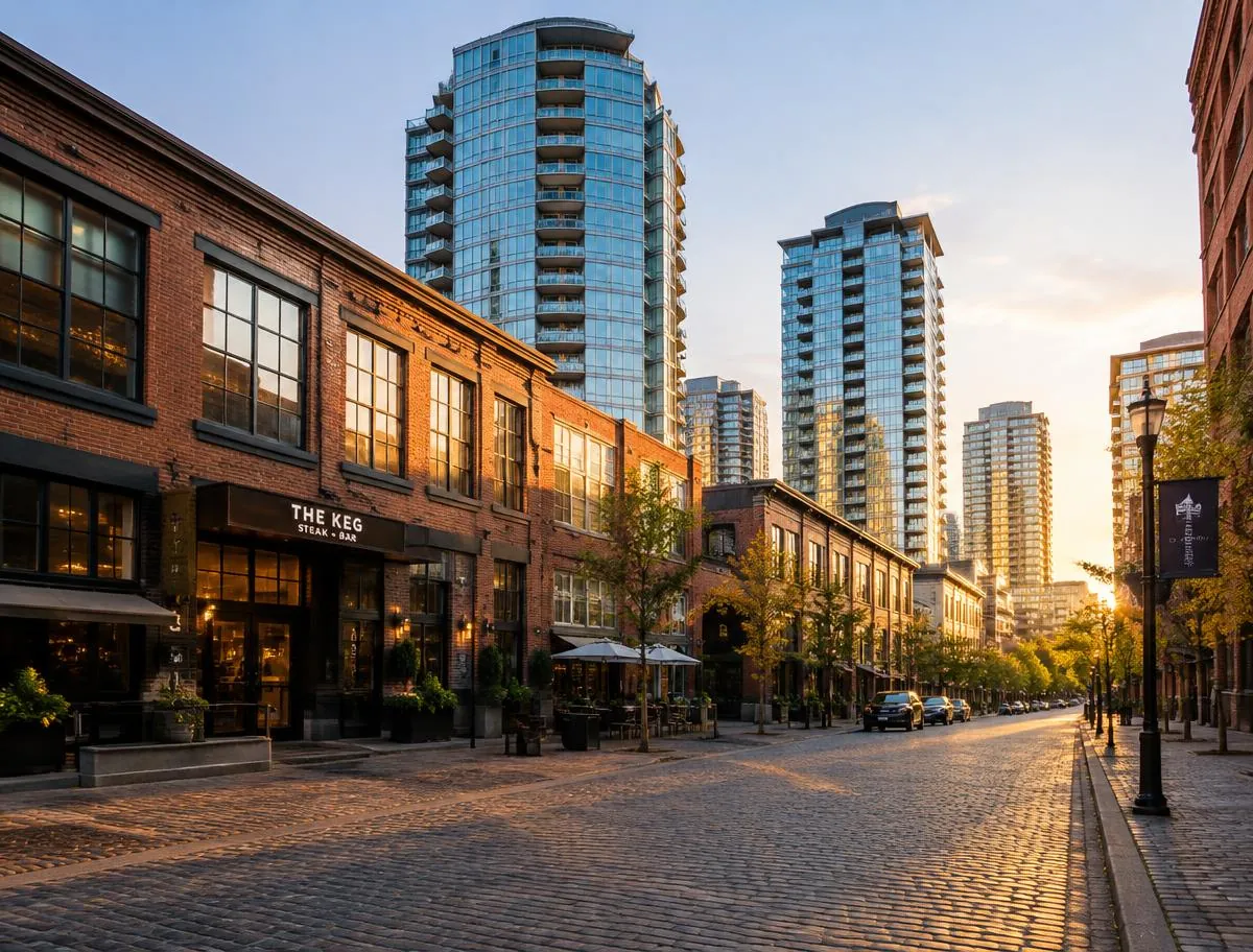
Yaletown sits on the north shore of False Creek in Downtown Vancouver: a warehouse district laid out in 1900, and the towers built on the Expo 86 lands under a City plan adopted in 1990. This guide covers its history, its homes and their assessed values, the rules for owners, and its parks, schools and transit, from public records.
Yaletown at a glance
Inside the boundary this page uses, Yaletown holds 14,046 strata lots on 86 strata plans, and 132 other titled parcels, on the City of Vancouver's 2026 tax roll.[1],[2],[3] The median BC Assessment value of a strata lot in Yaletown on that roll is $827,000, and half of them are valued between $628,000 and $1,214,000.[3] 6,009 of those strata lots, 42.8%, are in buildings BC Assessment dates to the 2000s, more than any other decade.[3] The largest strata plan in Yaletown is BCS2103 at 928 Homer Street, with 608 strata lots.[3] From 2017 to 2026, the City issued 986 building permits inside Yaletown, 8 of them for new buildings.[4] 7 City parks lie inside Yaletown. The largest is David Lam Park, at 4.34 hectares.[5]
Checked Oct 24, 2026, 9:39 PM PT against City of Vancouver open data.
- Strata lots (2026 tax roll)
- 14,046[3]
- Strata plans
- 86[3]
- Median assessed value, 2026 roll
- $827,000[3]
- Largest strata plan
- 928 Homer Street, 608 lots[3]
- SkyTrain stations inside
- Yaletown - Roundhouse[7]
- City parks inside
- 7[5]
- Heritage register sites
- 25[6]
- Building permits, 2017 to 2026
- 986[4]
- False Creek North plan adopted
- April 10, 1990 (By-law 6650)[8]
- Neighbourhood park the plan requires
- 17.05 hectares[8]
- Tower height limit, False Creek North
- 91 m; 110 m at Pacific and Homer and in two sub-areas[8]
- Height limit, Yaletown Historic Area
- 21.4 m, or the height on June 10, 1986[9]
- Expo 86 visitors
- 22,111,578[12]
- Downtown local area residents, 2016 census
- 62,030[13]
- Households renting, Downtown local area, 2016
- 57%[13]
Live from the MLS®
Homes for sale in Yaletown
238 homes are listed for sale in the MLS® area the board calls Yaletown. The newest are below.
 $1,698,000
Yaletown · Condo
2717 - 89 Nelson Street
2 bed2 bath1,055 sq ft
MLS® R3185481 · Listed by RE/MAX Masters Realty
 $750,000
Yaletown · Condo
602 - 1228 Homer Street
1 bed1 bath778 sq ft
MLS® R3185423 · Listed by RE/MAX Masters Realty
 $1,488,000
Yaletown · Condo
2302 - 1000 Beach Avenue
2 bed2 bath1,209 sq ft
MLS® R3185451 · Listed by Century 21 In Town Realty
 $1,158,000
Yaletown · Condo
2716 - 89 Nelson Street
2 bed2 bath827 sq ft
MLS® R3185442 · Listed by RE/MAX Masters Realty
 $899,000
Yaletown · Condo
807 - 950 Cambie Street
3 bed2 bath1,173 sq ft
MLS® R3185342 · Listed by Century 21 In Town Realty
 $1,290,000
Yaletown · Condo
801 - 980 Cooperage Way
2 bed2 bath1,162 sq ft
MLS® R3185204 · Listed by The Partners Real Estate
See all 238 homes for sale in Yaletown
Listing data is supplied by Greater Vancouver REALTORS® via MLS® through RealSaige. Information is deemed reliable but not guaranteed. Each card names the brokerage that holds the listing. Prices from $750,000 among the homes shown.
MLS® data last updated Nov 22, 2026, 1:00 PM PT.
The lines this page uses
Where Yaletown starts and ends
Smithe Street to the north-east, Richards Street to the north-west down to Pacific Street, then everything between Pacific Street and the False Creek shore as far west as the Burrard Bridge.[1]
The City of Vancouver describes historic Yaletown as the warehouse blocks bounded by Nelson, Homer, Drake and Pacific streets. This page draws Yaletown wider, to match the streets where homes are listed for sale as Yaletown: the east side of Richards Street and the False Creek North waterfront from the Burrard Bridge to the Cambie Bridge.[14],[1]
Every City figure on this page counts a parcel, permit or place when the City's own map point for it lies inside this line. A home on a boundary street can sit on either side.[2]
Yaletown: what and where
Yaletown is the part of Downtown Vancouver on the north shore of False Creek, between the Burrard Bridge and the Cambie Bridge. It holds two kinds of place side by side. One is a small district of brick and timber warehouses from the early 1900s, which the City protects as the Yaletown Historic Area. The other is a large group of residential towers, parks and seawall built from the 1990s onward on land the Province used for Expo 86.[14],[9],[8]
The City of Vancouver uses the name in two ways. Its description of historic Yaletown covers the warehouse blocks bounded by Nelson, Homer, Drake and Pacific streets. The towers along Pacific Boulevard and Marinaside Crescent sit in the area the City calls False Creek North, which its 1990 plan covers. Homes in both parts are listed for sale as Yaletown, so this page treats them as one neighbourhood and draws its line from Smithe Street and Richards Street down to the water.[14],[8],[1]
Yaletown has no census figures of its own. The City's 22 local areas were set in the 1960s, and the City notes that they leave out newer neighbourhoods such as Coal Harbour and Yaletown. Yaletown lies inside the City's Downtown local area, so population figures on this page are for that whole area and say so. The property figures come from the City's tax roll and permit records, counted inside the line on the map above.[13],[1],[2]
Yaletown through the years
1887-05-23
Engine 374 pulls the first passenger train to enter Vancouver.[15]
1888
The Canadian Pacific Railway completes its Roundhouse, turntable and machine shop on the north shore of False Creek.[16]
1900
The City lays out a new eight-block warehouse district bounded by Nelson, Homer, Drake and Pacific streets.[14]
1913
The warehouse at 1038 Hamilton Street is built, with a raised loading dock facing Mainland Street.[17]
1986-05-02
1986-10-13
Expo 86 closes with a final attendance of 22,111,578 visitors.[12]
1988
The Province sells the Expo lands to a group led by Li Ka-shing for $320 million, to be paid over 15 years.[19],[20]
1989-12-12
City Council approves its View Protection Guidelines, which the False Creek North plan later refers to.[8]
1990-04-10
Council adopts the False Creek North Official Development Plan, By-law 6650.[8]
1991
Council adopts the Central Area Plan and amends the Downtown plan for Downtown South.[14]
1995
David Lam Park is named for the 25th Lieutenant Governor of British Columbia.[21]
2006
George Wainborn Park receives a National Citation for design from the Canadian Society of Landscape Architects.[22]
2009-08-17
The Canada Line opens, with Yaletown-Roundhouse among its 16 stations.[10],[7]
2022-11-24
Bill 44 ends strata bylaws that restrict long-term rentals in British Columbia.[23]
2024-01-15
The Development Permit Board approves a 29-storey building on Expo Boulevard with 299 social housing homes.[24]
2025-12-05
The City announces construction at 95 Nelson Street: 283 non-market homes, a childcare centre and a new Firehall 8.[25]
The railway and the name, 1887 to 1900
The City of Vancouver sits on the unceded homelands of the Musqueam, Squamish and Tsleil-Waututh Nations, as the City states in its neighbourhood profiles. The north shore of False Creek became railway land after the Canadian Pacific Railway chose Vancouver as the western end of its line across Canada. The City's account of downtown history says the first passenger train arrived at the foot of Howe Street in 1887, a year after the city was incorporated.[13],[14]
Yaletown takes its name from Yale, a town in the Fraser Canyon. The name dates from when the railway moved its construction equipment and repair shops from Yale to its new western terminus, and the City records that whole houses were placed on flatcars and carried to the place that became known as Yaletown. The engine that pulled the first passenger train into Vancouver, on May 23, 1887, was Engine 374.[14],[15]
The railway's Roundhouse was completed in 1888, with its turntable and machine shop. The Vancouver Heritage Foundation describes these buildings as among the oldest industrial structures in the city. In the 20 years after the railway arrived, sawmills and shingle mills filled the north side of False Creek, according to the City.[16],[14]
The warehouse district, 1900 to the 1980s
By 1900, Vancouver had become the wholesale centre for western Canada, and the City laid out streets for a new eight-block warehouse district near the first Yaletown. This is the Yaletown most people know today, bounded by Nelson, Homer, Drake and Pacific streets. Its position next to the railway yards made it a cheap and convenient place to process, repackage and store goods.[14],[17]
The buildings were made to be loaded from rail cars and trucks. The warehouse at 1038 Hamilton Street, built in 1913 to a design by the architects Braunton and Leibert, is one example: its rear faces Mainland Street and has a raised loading dock. The City's zoning for the area describes buildings of heavy timber, brick and concrete, built from one property line to the next along narrow streets.[17],[9]
In the late 1920s the City's first plan zoned Yaletown for commercial and light industrial use. More warehouses were expected, but truck trailers drew industry toward the highways instead. By the 1950s so many homeowners had sold to factories and shops that Central School at Dunsmuir and Cambie closed, and the City writes that the area held little more than parking until the late 1970s and 1980s, when people began moving into the old warehouses.[14]
“The Yaletown Historic Area is a compact warehouse district developed in the early 1900s.”[9]
The heritage blocks today
The warehouse blocks are zoned HA-3, the City's zoning district for the Yaletown Historic Area. The rules encourage owners to convert and renovate the warehouses for a mix of commercial, industrial and home uses, and they require new buildings to follow the proportions, rhythm and details of the warehouses of the early 1900s. A building in HA-3 may rise to 21.4 metres, or keep a greater height it had on June 10, 1986. Homes may take up floor area of at most 3 times the site area, and buildings have no front, side or rear yards.[9]
The rules also protect the loading docks. For most uses, a parking garage at the level of a street, sidewalk or loading dock may hold no parking within 9.1 metres of any building face, apart from driveways, and that space may only be built as commercial or industrial space. The City's area history adds that Council has recognized the old truck loading docks and their overhanging canopies as a feature of the area, and recommends outdoor seating and other active uses on them.[9],[14]
On the City's 2026 tax roll, the HA-3 zone inside this page's boundary holds 599 strata lots and 25 other parcels. BC Assessment, which sets year built from permit records, dates 315 strata lots on 5 strata plans to buildings from the 1910s. The Vancouver Heritage Register lists 25 sites inside Yaletown, and the one in its group A is the railway Roundhouse at 181 Roundhouse Mews. In the City's data, 14 of the 25 are protected by municipal heritage designation. The warehouse at 1038 Hamilton Street, from 1913, is one of the buildings in this zone, and the Vancouver Heritage Foundation links it to the industrial origins of the area.[6],[3],[17]
Expo 86 on the north shore of False Creek
Expo 86, the world's fair on transportation and communications, opened on May 2, 1986, and closed on October 13, 1986. The City of Vancouver Archives gives its final attendance as 22,111,578 visitors. The Canadian Encyclopedia prints a figure of 20,111,578 visits, so the two sources differ by two million.[12],[18]
Before the fair, the provincial company BC Place Ltd. bought out 114 leases and other interests to assemble its land around False Creek, according to David Podmore, who oversaw that work, quoted in Business in Vancouver. The fair also left lasting public works. The Canada Pavilion became the convention centre and cruise ship terminal, the Expo Centre reopened as Science World by 1990, and the first SkyTrain line, linking Downtown to New Westminster, was built to coincide with the fair.[20],[18],[14]
Sources give different areas for these lands, because each measures something different. The Canadian Encyclopedia gives 67 hectares for the fair's main site along False Creek. Business in Vancouver gives 225 acres for all the land BC Place Ltd. assembled. The City describes False Creek North, the residential area planned on the north shore afterward, as an 83-hectare site.[18],[20],[14]
The 1988 sale and Concord Pacific
In 1988 the Province sold the Expo lands to a group from Hong Kong led by Li Ka-shing, for $320 million to be paid over 15 years. CBC News and Business in Vancouver both report those terms. Li Ka-shing's company in Vancouver, Concord Pacific, then carried out the development.[19],[20],[26],[27]
Stanley Kwok had been president of BC Place Ltd. from 1984 and sat on the board of the Expo 86 Corporation. He later represented Li Ka-shing's interests in the bid and became deputy chairman and president of Concord Pacific, as The Globe and Mail reported in 2025. That article says the planners gave priority to slender towers that were easy to live beside at ground level, and that Kwok favoured parks along the water.[27]
Writing in The Tyee in January 2025, Geoff Meggs reports that the Concord Pacific team had promised to finish by 2005, and that the last phase, in Northeast False Creek, remained undeveloped. The City's Northeast False Creek Plan for those lands has been in place since 2018.[26]
The False Creek North plan of 1990
City Council adopted the False Creek North Official Development Plan by By-law 6650 on April 10, 1990. An official development plan is the City's top-level guide for an area: every zoning by-law, park design and servicing agreement for the area must follow it, and it can change only after a public hearing. The plan was written for a set of residential neighbourhoods, parks, public buildings and shops on the water, facing south, close to the centre of the city.[8]
The plan sets seven organizing principles. Among them: False Creek North should join the rest of the city and avoid becoming a separate new town, the downtown street grid should extend into it, streets should organize the buildings, and planning should give children particular attention. It requires all housing to meet the City's guidelines for families with children, and a quarter of all homes to suit families with small children.[8]
The plan also lists what the developer had to provide. It requires 17.05 hectares of neighbourhood park and a continuous walk along the water. It requires sites for two elementary schools, a community centre and gymnasium of at least 4,180 square metres, at least eight child day care facilities, and space for a branch library if the Library Board asks for one, all at no cost to the City or the School Board. The City's area page describes the plan as 8,500 homes for more than 14,000 people on the 83-hectare site.[8],[14]
The plan has changed since 1990, and the City publishes it as a consolidated text with every amendment. Its current version sets social housing rules for new rezonings: 20% of the residential floor area must be social housing, and for three named sites, 1502 Granville Street, 431 Beach Crescent and 900 Pacific Boulevard, the 20% applies to the floor area above what their CD-1 zoning allowed on November 30, 2022. Rezoning applications received before that date may be exempt. The plan also fixed the 1987 shoreline as the base line for the waterfront, with only minor cuts and fills, and asks that shoreline work consider fish habitat, views from the water and recreation.[8]
How the towers were shaped
The plan sets the shape of the towers. Buildings in False Creek North may rise to 91 metres. A tower next to the southwest corner of Pacific Boulevard and Homer Street, and towers in two other sub-areas, may reach 110 metres. Any building taller than 35 metres must line up with the downtown street grid and be a point tower, which means a slim tower with a small floor area on each level. The plan allows two exceptions to the grid rule: the Plaza of Nations, and the Quayside neighbourhood, where buildings may follow the curve of the shore and of Pacific Boulevard.[8]
Views shaped the towers as well. The plan says development must keep views and create new ones, refers to the View Protection Guidelines that Council approved on December 12, 1989, and protects the view at the end of Georgia Street. Each tower's height was set at the zoning stage after looking at views, shadows on parks and streets, privacy and the buildings nearby.[8]
Business in Vancouver links this approach to Ray Spaxman, who became the City's director of planning in 1973. It reports that after Larry Beasley became co-director of planning in 1994, podiums and point towers spread along the north shore of False Creek, an approach that became known as Vancouverism. A podium is the low base of a building, often with townhomes or shops, under the tower.[20]
The homes in Yaletown today
Inside the boundary on this page, the City's 2026 tax roll lists 14,046 strata lots on 86 strata plans, and 132 other titled parcels. A strata lot is a unit with its own title, and a strata plan is the registered plan that divides a building or group of buildings into strata lots. A strata lot can be a home, a commercial unit, or another titled space.[3],[2]
One plan shows the range: LMS1008 at 1233 Pacific Boulevard has 453 strata lots, and their median assessed value on the 2026 roll is $39,900. The largest strata plan of homes is BCS2103 at 928 Homer Street, which also covers 909 Mainland Street, with 608 strata lots in a building BC Assessment dates to 2006.[3]
Most of Yaletown's strata lots are in buildings from two decades. BC Assessment's year built puts 6,009 strata lots in buildings from the 2000s and 5,383 in buildings from the 1990s. The 2010s added 1,643, and one building from the 2020s holds 375: plan EPS5752 at 1480 Howe Street, with a median assessed value of $979,000. The City's public art registry lists the sculpture Spinning Chandelier, installed in 2019, at the site it calls Vancouver House.[3],[28]
Most of the towers sit on CD-1 zoning, a zone written for one site or group of sites, which is how the False Creek North plan was carried out one sub-area at a time. The largest single group on the 2026 roll is the Downtown District zone, with 3,642 strata lots, followed by CD-1 (324) with 2,483. The heritage blocks hold 599.[3],[8]
Assessed values, 2016 to 2026
BC Assessment values every property in the province as of July 1, and the roll reflects each property's physical condition and zoning as of October 31. Notices go out on December 31, and an owner who disagrees must file a complaint by January 31. The City's tax roll for a given year therefore shows values set the July before. They are values for property tax, and a sale can happen above or below them.[29],[3]
Across the strata lots inside this page's boundary, the median assessed value was $581,000 on the 2016 roll, $768,000 on the 2017 roll and $911,000 on the 2019 roll. It reached $917,000 on the 2023 roll, the highest median in the table below, and stood at $827,000 on the 2026 roll. On that roll, a quarter of Yaletown's strata lots are valued below $628,000 and a quarter above $1,214,000.[3]
Two things shape the table. The count of strata lots grows over the years, from 12,749 on the 2016 roll to 14,046 on the 2026 roll, as new towers were titled, so each year's median describes a different set of homes. And the median includes every strata lot, among them the 453 strata lots on plan LMS1008 at 1233 Pacific Boulevard, whose median is $39,900. For a single building, the building guides on this site show its own values year by year.[3]
Renting, short stays and taxes for owners
In the 2016 census, 57% of households in the City's Downtown local area rented their home, compared with 53% across Vancouver. These are figures for the whole Downtown local area, which includes Yaletown, Coal Harbour and the business district.[13]
Since November 24, 2022, a strata corporation in British Columbia can no longer restrict owners from renting out their homes on long-term tenancies. Bill 44, the Building and Strata Statutes Amendment Act, 2022, took that power away and also ended age limits in strata bylaws, except a bylaw that requires residents to be at least 55. Strata corporations can still pass bylaws that restrict short-term and vacation rentals. Blakes, a law firm, notes in its summary of the act that a strata can no longer screen tenants, set screening criteria or require approval of a tenant, and that the 55 and older rule does not remove a current resident who was following the old bylaws, or a caregiver living with a resident.[23],[30]
Short-term rentals, meaning stays of less than 90 days in a row, need a City of Vancouver business licence. The home must be the host's principal residence, each person may hold one licence, and the strata or landlord must approve before the host applies. The licence costs $1,108 a year plus a $77 application fee. Vancouver is also on the Province's list of communities where short-term rentals are limited to the host's principal residence and one suite on the same property.[31],[32]
Two taxes apply to homes left empty. The City's Empty Homes Tax, started in 2017, asks every owner to declare each year how the home was used, and a home deemed or declared empty in 2025 pays 3% of its 2025 assessed taxable value. The Province's Speculation and Vacancy Tax is a separate annual tax based on how owners use residential property in the areas it covers, and its declaration is due by March 31.[33],[34]
Shops, public art and the streets
The False Creek North plan treated shops as a service for the people who would live there. It says retail should meet the needs of the new residents, link to the shopping streets that already existed, and avoid taking trade from older retail areas. It caps retail and service space outside the office areas at 55,948 square metres, of which retail alone may take 36,420, and it requires a grocery store at a site west of the stadium. Office space across False Creek North may not exceed 108,949 square metres, with office and shop space already in the Plaza of Nations counted separately.[8]
The streets were planned for people on foot. The plan uses streets as the main way to organize buildings, asks that primary entrances face the street, and calls for long streets such as Pacific Boulevard to be broken into sections at a comfortable scale for pedestrians. The Globe and Mail reports that the planners designed the streets for pedestrians, cyclists and trees, and made Pacific Boulevard into a grand route.[8],[27]
Public art was part of the plan from the start, with the details left to each sub-area zoning. The City's public art registry lists 22 works in place inside Yaletown today: 9 site-integrated works, 8 sculptures, 3 fountains or water features, 1 mosaic and 1 memorial. The most recent include Spinning Chandelier from 2019, Finger Paint from 2018, A False Creek from 2012 at the Cambie Bridge, and Boulevard from 2009.[8],[28]
New buildings and what is coming
From 2017 to 2026, the City issued 986 building permits inside Yaletown. Most of them, 972, were additions or alterations to existing buildings; 8 were for new buildings and 6 for temporary structures. The new building permits include a 45-storey residential and commercial tower at 1310 Richards Street in 2019, and two 5-storey buildings at 1461 and 1462 Granville Street in 2017, each with a declared value of $20,000,000.[4]
Three non-market housing buildings on former Concord Pacific land have building permits. On December 5, 2025, the City announced construction at 95 Nelson Street of a 28-storey building with 283 non-market homes, 117 of them designed for families, a 44-space childcare centre and a new four-bay Firehall 8 to replace the existing fire hall in Yaletown. The City expects it to be complete in 2029. The City, the Province through BC Housing, and Brightside Community Homes Foundation are partners, and the Province is providing $44.8 million to build the homes.[25],[4]
The second building is a 29-storey tower with 299 social housing homes, which the Development Permit Board approved on January 15, 2024, as 1050 Expo Boulevard; the building permit gives its address as 1010 Expo Boulevard. The third is a seven-storey building at 450 Pacific Street with 91 social housing homes. The City says the three sites come from a land transfer agreement with Concord Pacific for more than 670 affordable rental homes, and expects 450 Pacific Street to be complete in 2028 and the Expo Boulevard tower in 2029.[24],[4],[25]
Getting around
Yaletown-Roundhouse station on the Canada Line sits inside the neighbourhood. The Canada Line opened on August 17, 2009, three and a half months ahead of schedule, as a 19-kilometre line with 16 stations, and the Government of Canada's release at the opening gave the trip from downtown to the airport as 25 minutes. TransLink reports more than 120,000 boardings on an average weekday in 2023, and says the deepest part of the line is the tunnel under False Creek between Olympic Village and Yaletown-Roundhouse. The Government of Canada, the Province, TransLink, the Vancouver Airport Authority and the private partner InTransitBC funded the $2 billion project.[10],[11],[7]
Measured in a straight line from the centre of the neighbourhood, Vancouver City Centre station on the Canada Line is 962 metres away, Olympic Village station 1,000 metres, and Stadium-Chinatown station on the Expo Line 1,205 metres. Walking routes are longer.[7]
The seawall runs along the whole Yaletown waterfront. The City describes it as a 28-kilometre path from the Vancouver Convention Centre to Spanish Banks, divided into two marked sections. The False Creek North plan required the walkway to be finished along the shore, and set aside space for a streetcar line along Pacific Boulevard.[35],[8]
In the 2016 census, two-thirds of commuters living in the Downtown local area got to work without a car, and they were more than three times as likely as other Vancouver residents to walk to work. More than two-thirds of Downtown workers had a commute under half an hour.[13]
Parks and the waterfront
The City lists 7 parks inside Yaletown. David Lam Park, at 4.34 hectares, is the largest, followed by George Wainborn Park at 2.49 hectares and Coopers' Park at 1.71 hectares. The others are Roundhouse Turntable Plaza, May and Lorne Brown Park, Helmcken Park and Yaletown Park. Emery Barnes Park lies just outside the boundary.[5]
David Lam Park was named in 1995 for David See-Chai Lam, Lieutenant Governor of British Columbia from 1988 to 1995. George Wainborn Park is named for George Wainborn, a long-serving Park Board commissioner, and received a 2006 National Citation for design from the Canadian Society of Landscape Architects, which notes its water feature, its play area of boulders and shaped land, and the conversion of a polluted industrial site into public space.[21],[22]
Dog owners have an off-leash area inside the neighbourhood at Coopers' Park, and more nearby at Emery Barnes Park and Charleson Park. The False Creek North plan allowed marinas at set places along the shore, and asked that the marina at the end of Davie Street offer public access.[36],[8]
Schools, childcare and the Roundhouse
Elsie Roy Elementary, at 150 Drake Street, is the public school inside Yaletown. The Vancouver School Board describes it as a full school that operates at capacity, with some children from its catchment on a waitlist and attending nearby schools instead. False Creek Elementary is 755 metres from the centre of the neighbourhood in a straight line. The school a child attends depends on the catchment for the home's address, so families should check it for each home.[37],[38]
The Roundhouse is Yaletown's community centre. The Vancouver Heritage Foundation records that after Expo 86 the old railway building was restored as the community centre and extended to house Engine 374, and lists the site as provincially protected. The City writes that the engine sat in Kitsilano Park for many years before rail enthusiasts restored it for Expo 86, and that it now stands in a glass pavilion as a designated heritage monument.[16],[15],[39]
The neighbourhood has no public library branch inside its boundary. The Central Branch of the Vancouver Public Library is 893 metres from the centre of Yaletown in a straight line. For childcare, the False Creek North plan required at least eight licensed child day care facilities across the area, and the building at 95 Nelson Street will add 44 licensed spaces run by the Vancouver Society of Children's Centres.[40],[8],[25]
Who lives in the Downtown local area
The most recent City profile of the Downtown local area uses the 2016 census, which counted 62,030 residents on 3.8 square kilometres, more than seven thousand more than in 2011. Downtown's population density was 162 people per hectare, three times the city as a whole. From 1996 to 2016 its population grew by 256%. Yaletown is one part of that area, and the City has no separate count for it.[13]
Households downtown are small. In 2016 the average private household held 1.7 people, compared with 2.2 across the city, and 31% of residents lived alone, compared with 18% across the city. A majority of homes downtown had one bedroom or fewer, and the City notes that the area has little ground-oriented housing. In the year before the census, 25% of Downtown residents had moved.[13]
The age mix has changed as the area grew. The City counts 69% more seniors, aged 65 and older, than children aged 14 and under in the Downtown local area. From 1996 to 2016 the number of children there grew by 590% and the number of seniors by 276%. Over 1,400 residents, 2.4% of Downtown's population, identified as Indigenous in 2016, the same share as the city as a whole. The City also reports that 25% of people living Downtown had incomes below the Market Basket Measure, Canada's official poverty line, which compares a family's disposable income with the cost of basic needs.[13]
BC Assessment, City of Vancouver tax roll
Assessed values in Yaletown by year
| Tax roll | Strata lots | Lower quarter | Median | Upper quarter |
|---|---|---|---|---|
| 2026 | 14,046 | $628,000 | $827,000 | $1,214,000 |
| 2025 | 14,046 | $671,000 | $882,000 | $1,302,000 |
| 2024 | 14,044 | $697,000 | $914,000 | $1,334,000 |
| 2023 | 14,044 | $702,000 | $917,000 | $1,364,000 |
| 2022 | 14,043 | $678,000 | $885,000 | $1,320,000 |
| 2021 | 14,043 | $659,000 | $842,000 | $1,272,000 |
| 2020 | 14,043 | $640,000 | $827,000 | $1,266,750 |
| 2019 | 13,668 | $692,000 | $911,000 | $1,416,000 |
| 2018 | 13,106 | $640,000 | $858,000 | $1,328,000 |
| 2017 | 13,022 | $572,000 | $768,000 | $1,183,000 |
| 2016 | 12,749 | $440,000 | $581,000 | $893,000 |
A quarter of the strata lots are valued below the lower quarter figure, and a quarter above the upper one. BC Assessment values as published in the City of Vancouver tax roll, for property tax. A strata lot can be a home, a commercial unit or another titled space. Earlier years count only the land parcels that still carry the same land coordinate today, so towers on newer parcels join the count in the year their strata lots first appear. The City says legal descriptions in this data are not definitive. Retrieved Oct 24, 2026, 9:39 PM PT.[3]
BC Assessment year built
When Yaletown's strata buildings were built
| Decade built | Strata plans | Strata lots | Share of lots |
|---|---|---|---|
| 1910s | 5 | 315 | 2.2% |
| 1980s | 4 | 321 | 2.3% |
| 1990s | 35 | 5,383 | 38.3% |
| 2000s | 35 | 6,009 | 42.8% |
| 2010s | 6 | 1,643 | 11.7% |
| 2020s | 1 | 375 | 2.7% |
Each strata plan is dated by the median year built BC Assessment gives its strata lots on the 2026 roll. BC Assessment sets year built from permit records, so a converted heritage building can carry its original year.[3]
2026 tax roll
The largest strata buildings in Yaletown
| Address | Plan | Strata lots | Built | Median value |
|---|---|---|---|---|
| 928 Homer Street | BCS2103 | 608 | 2006 | $599,000 |
| 89 Nelson Street | EPS5890 | 560 | 2019 | $624,000 |
| 928 Beatty Street | BCS1437 | 541 | 2005 | $646,000 |
| 1008 Cambie Street | LMS2995 | 535 | 1997 | $690,000 |
| 198 Aquarius Mews | LMS3903 | 481 | 1999 | $889,500 |
| 1233 Pacific Boulevard | LMS1008 | 453 | 1993 | $39,900 |
| 68 Smithe Street | EPS3602 | 434 | 2016 | $640,500 |
| 1033 Marinaside Crescent | LMS4555 | 406 | 2002 | $1,057,000 |
| 431 Pacific Street | VAS2540 | 379 | 1993 | $792,000 |
| 1480 Howe Street | EPS5752 | 375 | 2020 | $979,000 |
| 193 Aquarius Mews | LMS4255 | 369 | 2000 | $1,018,500 |
| 939 Homer Street | LMS2969 | 307 | 1998 | $572,000 |
One strata plan can cover more than one street address, and the address shown is one of them. A strata lot can be a home or a commercial unit.[3]
City of Vancouver, 2017 to 2026
New buildings since 2017
The City issued 986 building permits inside Yaletown from 2017 to 2026. Addition / Alteration: 972. New Building: 8. Temporary Building / Structure: 6.[4]
By year: 2017: 137 · 2018: 129 · 2019: 131 · 2020: 89 · 2021: 137 · 2022: 85 · 2023: 67 · 2024: 71 · 2025: 70 · 2026: 70
2026-05-08 · 95 Nelson Street · $167,907,400 · BP-2024-01783
To construct a mixed-use building
2025-06-03 · 450 Pacific Street · $59,537,000 · BP-2024-02461
To construct a new 7-storey wood frame housing development
2025-05-29 · 1010 Expo Boulevard · $193,259,300 · BP-2024-01205
To construct a 29 storey residential tower with 299 social housing units over 4 storeys of below grade parking. The project will include the following components:
2022-06-01 · 1020 Marinaside Crescent · $280,300 · DB-2021-05080
To install a 4.9 m2 prefabricated single stall washroom in this city owned park.
2019-03-13 · 1050 Beach Avenue · $1,163,655 · BP-2019-00470
Alterations to include removing the existing abutment, pier, ramp, marine float and pilings, and to install one new abutment, one ramp, four gangways, three floating platforms, one fixed platform, one floating ferry float/dock with passenger shelter, pilings, low level lights and domestic water, for this existing Vancouver Aquatic Centre use on this site. NOTE: ASHRAE is not applicable, and, NFPA 303 is not required.
2019-02-25 · 1310 Richards Street · $0 · BU460645
To construct a 45-storey residential/commercial building containing Retail "shell" (496 Drake St) and Restaurant Class 1 "shell" (1330 Richards St) on the 1st storey, 273 dwelling units on the second through forty-fifth storeys and mechanical penthouse over 6 levels of underground parking accessed from the lane east of Richards Street, thereby granting relaxation of loading.
2017-11-07 · 1462 Granville Street · $20,000,000 · BP-2017-00286
To construct a 5 storey with a mezzanine (Level 6) commercial building
2017-08-28 · 1461 Granville Street · $20,000,000 · BP-2017-00284
To construct a 5 storey mixed-use building
Values are the construction values declared on each permit. A large project can be issued in stages, each with its own permit.
City of Vancouver open data
Parks, schools and services in Yaletown
Parks[5]
- David Lam Park · 4.34 haInside
- George Wainborn Park · 2.49 haInside
- Coopers' Park · 1.71 haInside
- Roundhouse Turntable Plaza · 0.91 haInside
- May & Lorne Brown Park · 0.25 haInside
- Helmcken Park · 0.17 haInside
- Yaletown Park · 0.17 haInside
SkyTrain stations[7]
- Yaletown - RoundhouseInside
- Vancouver City Center962 m
- Olympic Village1,000 m
- Stadium - Chinatown1,205 m
Schools[38]
- Elsie Roy Elementary · Public SchoolInside
- Anchor Point Montessori · Independent School667 m
- False Creek Elementary · Public School755 m
Community centres[39]
- RoundhouseInside
- Gathering Place Community Centre497 m
Libraries[40]
- Outreach Services893 m
Dog off-leash areas[36]
- Coopers' Park · 6 AM to 10 PMInside
- Coopers' Park · 6 AM to 10 PMInside
- Emery Barnes · 6 AM to 10 PM371 m
"Inside" means the City's map point for the place lies inside the boundary above. Other distances are straight lines from the centre of the neighbourhood, measured Oct 24, 2026, 9:39 PM PT. Walking routes are longer, and a school's catchment decides who attends it.
City of Vancouver open data
Heritage register and public art
The Vancouver Heritage Register lists 25 sites inside Yaletown: 1 in evaluation group A, 7 in group B and 17 in group C. 14 are protected by municipal heritage designation.[6]
Group A sites: CPR Roundhouse, 181 ROUNDHOUSE MEWS.[6]
The City's public art registry lists 22 works in place inside Yaletown. The most recent include Spinning Chandelier (2019), Finger Paint (2018), A False Creek (2012), Boulevard (2009).[28]
Building guides in Yaletown
Grace, 1280 Richards Street
A James Schouw tower at Richards and Drake, approved in principle in 2002 and dated 2008 by BC Assessment, with 48 strata lots here and 23 Drake and Richards Street lots on the same strata plan, 247 m from Yaletown-Roundhouse Station.
Beach Tower, 1500 Hornby Street
Beach Tower, the 33-storey tower of 888 Beach at Hornby Street and Beach Avenue, designed by James K.M. Cheng Architects and dated 1993 by BC Assessment, with 164 strata lots here and 95 more at Howe Street and Beach Avenue addresses on the same strata plan.
H&H, 1133 Homer Street
A 16-storey building at Homer and Helmcken, finished in 2008, with 175 strata lots at this address and 15 townhomes on the same strata plan, 207 m from Yaletown-Roundhouse Station.
Mariner, 918 Cooperage Way
A Concord Pacific tower by Coopers' Park, approved in 2004, with 133 strata lots here and 112 more at 8 Smithe Mews, a second tower on the same strata plan (2026 tax roll).
The Bentley, 1001 Homer Street
A 24-storey Polygon tower at Homer and Nelson, approved in 2002 and dated 2005 by BC Assessment, with 146 strata lots here and 4 Homer Street townhomes on the same strata plan, 336 m from Yaletown-Roundhouse Station.
Governor's Tower, 388 Drake Street
A Concord Pacific tower at Drake Street and Pacific Boulevard, rezoned in 1990 as part of Yaletown Edge and dated 1995 by BC Assessment, with 135 strata lots here and 102 Homer Street lots on the same strata plan, 235 m from Yaletown-Roundhouse Station.
Questions about Yaletown
Why is it called Yaletown?
Yaletown is named after Yale, a town in the Fraser Canyon. The name comes from the time the Canadian Pacific Railway moved its construction equipment and repair shops from Yale to Vancouver, its new western terminus. The City of Vancouver records that whole houses were carried on flatcars to the place that became known as Yaletown, on the north shore of False Creek.[14]
Where are the boundaries of Yaletown?
The City of Vancouver describes historic Yaletown as the warehouse blocks bounded by Nelson, Homer, Drake and Pacific streets. Homes listed for sale as Yaletown cover a wider area: the east side of Richards Street from Smithe Street down, and the False Creek North waterfront from the Burrard Bridge to the Cambie Bridge. This guide uses that wider area for its City figures, shown on the map.[14],[1]
What was Yaletown before the condos?
Yaletown began as railway land in the 1880s, and in 1900 the City laid out an eight-block warehouse district there for storing and repackaging goods. From the 1920s it was zoned for commerce and light industry. The City says the area then held little more than parking until the late 1970s and 1980s, when people began moving into the old warehouses.[14]
Who developed the Yaletown waterfront towers?
The Yaletown waterfront towers stand on the former Expo 86 lands, which the Province sold in 1988 to a group led by Li Ka-shing for $320 million over 15 years. His company, Concord Pacific, developed the area under the City's False Creek North Official Development Plan, adopted on April 10, 1990. Each building guide on this site names that building's developer and architect where public records show them.[19],[20],[26],[8]
How tall can buildings be in Yaletown?
In the False Creek North part of Yaletown, buildings may rise to 91 metres, and 110 metres for a tower next to the southwest corner of Pacific Boulevard and Homer Street and in two other sub-areas. Towers above 35 metres must be slim point towers lined up with the street grid. In the heritage blocks of the Yaletown Historic Area, the limit is 21.4 metres, or a building's height on June 10, 1986.[8],[9]
Can a strata in Yaletown stop me renting out my condo?
No. Since November 24, 2022, strata corporations in British Columbia cannot restrict owners from renting their homes on long-term tenancies, under Bill 44, the Building and Strata Statutes Amendment Act, 2022. That applies to every Yaletown strata. A strata can still pass bylaws that restrict short-term and vacation rentals, and it may keep or pass a bylaw that requires residents to be 55 or older.[23]
Can I rent my Yaletown condo on Airbnb?
Only as your principal residence, with a City of Vancouver short-term rental licence. Stays under 90 days in a row need the licence, which costs $1,108 a year plus a $77 application fee. Your strata or landlord must approve before you apply, and each person may hold one licence. Vancouver is also covered by the Province's principal residence requirement for short-term rentals.[31],[32]
Do Yaletown condo owners pay the Empty Homes Tax?
Every owner of a Yaletown home must declare each year how it was used, for the City of Vancouver's Empty Homes Tax, which started in 2017. A home deemed or declared empty in 2025 pays 3% of its 2025 assessed taxable value. The Province's Speculation and Vacancy Tax needs its own declaration by March 31.[33],[34]
When are BC Assessment values for Yaletown condos set?
BC Assessment values each Yaletown condo as of July 1 of the year before the tax roll, using the home's condition and zoning as of October 31. Notices are mailed on December 31, and an owner who disagrees must file a complaint by January 31. The values on this page come from the City of Vancouver's tax roll, which publishes those BC Assessment figures.[29],[3]
How do I get from Yaletown to the airport?
Take the Canada Line from Yaletown-Roundhouse station, inside the neighbourhood, south toward the airport. When the line opened on August 17, 2009, the Government of Canada gave the trip from downtown to the airport as 25 minutes. The line has 16 stations, and TransLink reported more than 120,000 boardings on an average weekday in 2023.[10],[11],[7]
What is the Roundhouse in Yaletown?
The Roundhouse is the Canadian Pacific Railway building at 181 Roundhouse Mews, completed in 1888 with its turntable and machine shop. After Expo 86 it was restored as Yaletown's community centre and extended with a glass pavilion for Engine 374, which pulled the first passenger train into Vancouver on May 23, 1887. The Vancouver Heritage Register places it in its group A.[16],[15],[6]
Is there a dog park in Yaletown?
Yes. The City of Vancouver lists an off-leash area at Coopers' Park, inside Yaletown. Two more are close by, at Emery Barnes Park and Charleson Park, both outside the boundary on this page. The City lists posted hours for each off-leash area, so check them before you go.[36]
How many people live in Yaletown?
No official count exists for Yaletown alone. The City's local areas were set in the 1960s and leave out newer neighbourhoods such as Yaletown, which lies inside the Downtown local area. In the 2016 census, the Downtown local area had 62,030 residents on 3.8 square kilometres, with 1.7 people in the average household. Yaletown holds 14,046 strata lots on the 2026 tax roll.[13],[3]
What are the heritage rules for the old Yaletown warehouses?
The old Yaletown warehouses sit in the Yaletown Historic Area, a zone the City labels HA-3. The rules encourage converting and renovating the warehouses for a mix of commercial, industrial and home uses, and require new buildings to follow the proportions and details of the early 1900s warehouses. Buildings may rise to 21.4 metres, homes may use floor area of at most 3 times the site, and for most uses, parking at loading dock level must stay 9.1 metres back from the building face.[9]
What did the False Creek North plan promise Yaletown residents?
The False Creek North plan of 1990 requires 17.05 hectares of neighbourhood park, a continuous walkway along the water, sites for two elementary schools, a community centre and gymnasium of at least 4,180 square metres, at least eight child day care facilities, and space for a library branch if the Library Board asks for one. A quarter of all homes must suit families with small children.[8]
What is being built at 95 Nelson Street in Yaletown?
At 95 Nelson Street the City of Vancouver, the Province through BC Housing, and Brightside Community Homes Foundation are building a 28-storey building with 283 non-market homes, 117 of them designed for families, a 44-space childcare centre, and a new four-bay Firehall 8 to replace the existing fire hall in Yaletown. The City announced construction on December 5, 2025, and expects it to be complete in 2029.[25]
How many condos are there in Yaletown?
The City of Vancouver's 2026 tax roll lists 14,046 strata lots on 86 strata plans inside the Yaletown boundary this page uses. A strata lot is a unit with its own title, so the count can include commercial strata units as well as homes. A building on a single title counts as one parcel.[3],[1]
What is the median assessed value of a condo in Yaletown?
On the 2026 tax roll, the median BC Assessment value of the strata lots in Yaletown is $827,000. A quarter are valued below $628,000 and a quarter above $1,214,000. These are BC Assessment values for property tax. A sale price can be higher or lower.[3]
Which SkyTrain stations are in or near Yaletown?
Yaletown - Roundhouse station is inside Yaletown. Measured in a straight line from the centre of the neighbourhood, the nearest stations are Yaletown - Roundhouse (148 m), Vancouver City Center (962 m) and Olympic Village (1,000 m). Walking routes are longer.[7]
What parks are in Yaletown?
The City lists 7 parks inside Yaletown: David Lam Park (4.34 ha), George Wainborn Park (2.49 ha), Coopers' Park (1.71 ha), Roundhouse Turntable Plaza (0.91 ha), May & Lorne Brown Park (0.25 ha), Helmcken Park (0.17 ha) and Yaletown Park (0.17 ha). Park sizes are the City's figures in hectares; one hectare is 10,000 square metres.[5]
Which schools are in Yaletown?
The City's school list places Elsie Roy Elementary (public school) inside Yaletown. The nearest schools to the centre of the neighbourhood are Elsie Roy Elementary (161 m), Anchor Point Montessori (667 m) and False Creek Elementary (755 m). The school a child attends depends on the Vancouver School Board catchment for the home's address.[38]
When were the condo buildings in Yaletown built?
BC Assessment's year built puts 6,009 of the 14,046 strata lots in Yaletown, 42.8%, in buildings from the 2000s. By decade: 1910s 315 lots on 5 plans, 1980s 321 lots on 4 plans, 1990s 5,383 lots on 35 plans, 2000s 6,009 lots on 35 plans, 2010s 1,643 lots on 6 plans, 2020s 375 lots on 1 plan.[3]
How many heritage buildings are in Yaletown?
The Vancouver Heritage Register lists 25 sites inside Yaletown: 1 in group A, 7 in group B and 17 in group C. The City describes the groups as general classifications based on historic, architectural, cultural, spiritual, scientific or social values. 14 of them are protected by municipal designation.[6]
What new buildings has the City approved in Yaletown?
From 2017 to 2026, the City issued 8 building permits for new buildings inside Yaletown, with a declared construction value of $462,147,655 in all, out of 986 building permits of every kind, of which 972 were additions or alterations to existing buildings.[4]
Sources
- [1]City of Vancouver. Local area boundary and street intersections. Checked 2026-10-24. Open data, Open Government Licence - Vancouver.
- [2]City of Vancouver. Property parcel polygons and property addresses. Checked 2026-10-24. Open data, Open Government Licence - Vancouver.
- [3]City of Vancouver. Property tax report (BC Assessment values), 2016 to 2026. Checked 2026-10-24. Open data, Open Government Licence - Vancouver.
- [4]City of Vancouver. Issued building permits. Checked 2026-10-24. Open data, Open Government Licence - Vancouver.
- [5]City of Vancouver. Parks. Checked 2026-10-24. Open data, Open Government Licence - Vancouver.
- [6]City of Vancouver. Heritage sites (Vancouver Heritage Register). Checked 2026-10-24. Open data, Open Government Licence - Vancouver.
- [7]City of Vancouver. Rapid transit stations. Checked 2026-10-24. Open data, Open Government Licence - Vancouver.
- [8]City of Vancouver. False Creek North Official Development Plan (By-law No. 6650, April 10, 1990), consolidated. Checked 2026-10-24. Read from the Internet Archive copy of 2026-02-14.
- [9]City of Vancouver. HA-3 District Schedule, Zoning and Development By-law, 2025-11. Checked 2026-10-24. Read from the Internet Archive copy of 2026-04-13.
- [10]Government of Canada. Canada Line begins service with fare-free day, 2009-08-17. Checked 2026-10-24.
- [11]TransLink. SkyTrain's Canada Line marks 15th anniversary, 2024-08-16. Checked 2026-10-24.
- [12]City of Vancouver Archives. Our Expo 86 holdings, 2016-04-28. Checked 2026-10-24.
- [13]City of Vancouver. Social Indicators and Trends: Neighbourhood Profiles 2020, Downtown, 2020-10-02. Checked 2026-10-24. 2016 census figures for the Downtown local area.
- [14]City of Vancouver. Downtown (area history and neighbourhoods). Checked 2026-10-24. Read from the Internet Archive copy of 2026-09-22; the City site refuses scripts.
- [15]City of Vancouver. Engine 374 at the Roundhouse Community Centre. Checked 2026-10-24. Read from the Internet Archive copy of 2026-01-09.
- [16]Vancouver Heritage Foundation. Vancouver Heritage Site Finder: 181 Roundhouse Mews. Checked 2026-10-24.
- [17]Vancouver Heritage Foundation. Vancouver Heritage Site Finder: 1038 Hamilton St. Checked 2026-10-24.
- [18]The Canadian Encyclopedia. Expo 86, 2015-03-04. Checked 2026-10-24. Last edited date.
- [19]CBC News. Deal of the century: Expo 86 land purchase changed Vancouver, 2016-05-04. Checked 2026-10-24. By Jason Proctor.
- [20]Business in Vancouver. Expo 86 Effect: A Vancouver developing legacy, 2016-04-26. Checked 2026-10-24. By Peter Mitham.
- [21]The Canadian Encyclopedia. David See-Chai Lam, 2018-06-14. Checked 2026-10-24. Last edited date.
- [22]Canadian Society of Landscape Architects. Awards Atlas: George Wainborn Park, 2006 National Citation. Checked 2026-10-24.
- [23]Blake, Cassels & Graydon LLP. New B.C. Legislation Seeks to Expand Housing Supply, 2022-12-09. Checked 2026-10-24. Legal bulletin on Bill 44.
- [24]City of Vancouver. Development Permit Board minutes, January 15, 2024, 2024-01-15. Checked 2026-10-24. Read from the Internet Archive copy of 2025-10-12.
- [25]City of Vancouver. New affordable homes, childcare and firehall coming to Northeast False Creek, 2025-12-05. Checked 2026-10-24. Read from the Internet Archive copy of 2026-01-21.
- [26]The Tyee. A Long-Delayed Vancouver Housing Megaproject Is Closer to Reality, 2025-01-09. Checked 2026-10-24. Analysis by Geoff Meggs.
- [27]The Globe and Mail. Urban planner Stanley Kwok combined high density and livability in Expo 86 redevelopment, 2025-12-18. Checked 2026-10-24. By Kerry Gold.
- [28]City of Vancouver. Public art. Checked 2026-10-24. Open data, Open Government Licence - Vancouver.
- [29]BC Assessment. Key dates. Checked 2026-10-24.
- [30]Global News. B.C. strata rental restriction changes: reaction, 2022-11-23. Checked 2026-10-24. By Amy Judd and Aaron McArthur.
- [31]City of Vancouver. Short-term rental business licence. Checked 2026-10-24. Read from the Internet Archive copy of 2026-09-10.
- [32]Government of British Columbia. Principal residence requirement for short-term rentals, 2026-09-21. Checked 2026-10-24. Last updated date.
- [33]City of Vancouver. Empty Homes Tax. Checked 2026-10-24. Read from the Internet Archive copy of 2026-10-17.
- [34]Government of British Columbia. Speculation and vacancy tax. Checked 2026-10-24.
- [35]City of Vancouver. Seawall in Vancouver. Checked 2026-10-24. Read from the Internet Archive copy of 2026-10-16.
- [36]City of Vancouver. Dog off-leash areas. Checked 2026-10-24. Open data, Open Government Licence - Vancouver.
- [37]Vancouver School Board. Elsie Roy Elementary: About us. Checked 2026-10-24.
- [38]City of Vancouver. Schools. Checked 2026-10-24. Open data, Open Government Licence - Vancouver.
- [39]City of Vancouver. Community centres. Checked 2026-10-24. Open data, Open Government Licence - Vancouver.
- [40]City of Vancouver. Libraries. Checked 2026-10-24. Open data, Open Government Licence - Vancouver.