
Neighbourhood guide · V6E / V6G
West End
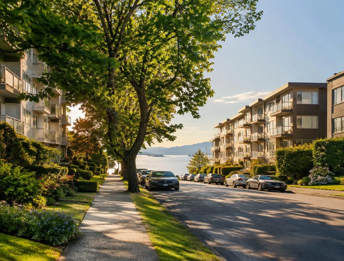
The West End fills the downtown peninsula between Burrard Street and Stanley Park, south of West Georgia Street. Victorian houses came in the 1890s and more than 220 high-rises between 1962 and 1975. This guide covers its history, its 2013 plan, its homes and their assessed values, the rules for owners, and its beaches, parks, schools and transit, from public records.
West End at a glance
Inside the boundary this page uses, West End holds 9,888 strata lots on 211 strata plans, and 781 other titled parcels, on the City of Vancouver's 2026 tax roll.[1],[2],[3] The median BC Assessment value of a strata lot in West End on that roll is $796,000, and half of them are valued between $618,000 and $1,180,000.[3] 3,141 of those strata lots, 31.8%, are in buildings BC Assessment dates to the 1990s, more than any other decade.[3] The largest strata plan in West End is LMS3094 at 720 Jervis Street, with 486 strata lots.[3] From 2017 to 2026, the City issued 2,498 building permits inside West End, 27 of them for new buildings.[4] 6 City parks lie inside West End. The largest is English Bay Beach Park, at 9.83 hectares.[5]
Checked Oct 24, 2026, 9:39 PM PT against City of Vancouver open data.
- Strata lots (2026 tax roll)
- 9,888[3]
- Strata plans
- 211[3]
- Median assessed value, 2026 roll
- $796,000[3]
- Largest strata plan
- 720 Jervis Street, 486 lots[3]
- Nearest SkyTrain station
- Burrard, 1,126 m from the centre[7]
- City parks inside
- 6[5]
- Heritage register sites
- 135[6]
- Building permits, 2017 to 2026
- 2,498[4]
- West End Community Plan approved
- November 20, 2013, by City Council[8]
- West End local area residents, 2016 census
- 47,200[9]
- Population density, 2016 census
- 231 people per hectare[9]
- Households renting, West End local area, 2016
- 80%, against 53% across Vancouver[9]
- Average household size, 2016
- 1.5 people, against 2.2 across Vancouver[9]
- High-rises built from 1962 to 1975
- More than 220, by the City's count[10]
- Area in the 2013 plan
- 204 hectares on 112 city blocks[8]
- Width of every West End laneway
- 10 metres, against 6 metres elsewhere in Vancouver[8]
Live from the MLS®
Homes for sale in West End
247 homes are listed for sale in the MLS® area the board calls West End VW. The newest are below.
 $1,399,000
West End · Condo
1202 - 1005 Beach Avenue
2 bed2 bath1,060 sq ft
MLS® R3184799 · Listed by Coldwell Banker Prestige Realty
 $1,098,000
West End · Condo
3206 - 1200 W Georgia Street
2 bed2 bath1,002 sq ft
MLS® R3184429 · Listed by Royal Pacific Lions Gate Realty Ltd.
 $1,049,000
West End · Condo
301 - 789 Jervis Street Street
2 bed2 bath1,086 sq ft
MLS® R3184587 · Listed by eXp Realty
 $1,149,900
West End · Condo
908 - 1028 Barclay Street
2 bed2 bath1,127 sq ft
MLS® R3184063 · Listed by Oakwyn Realty Ltd.
 $998,800
West End · Condo
1403 - 1111 Haro Street
2 bed2 bath1,069 sq ft
MLS® R3183985 · Listed by Macdonald Realty
 $799,000
West End · Condo
902 - 1200 Alberni Street
2 bed2 bath888 sq ft
MLS® R3184265 · Listed by Sutton Group - 1st West Realty
See all 247 homes for sale in West End
Listing data is supplied by Greater Vancouver REALTORS® via MLS® through RealSaige. Information is deemed reliable but not guaranteed. Each card names the brokerage that holds the listing. Prices from $799,000 among the homes shown.
MLS® data last updated Nov 22, 2026, 1:00 PM PT.
The lines this page uses
Where West End starts and ends
The City's West End local area: west of Burrard Street and south of West Georgia Street, from Coal Harbour to English Bay and Stanley Park.[1]
The City of Vancouver publishes this boundary as one of its 22 local areas. Homes listed for sale as West End sit inside it.[1],[10],[9]
Every City figure on this page counts a parcel, permit or place when the City's own map point for it lies inside this line. A home on a boundary street can sit on either side.[2]
The West End: what and where
The West End is the part of Vancouver's downtown peninsula west of Burrard Street and south of West Georgia Street, running out to Stanley Park and English Bay. The City of Vancouver describes it as lying west of Downtown, with water on three sides: English Bay, Coal Harbour and Lost Lagoon in Stanley Park. Its local shops and restaurants are on Davie Street and Denman Street, the City says, and its larger stores are on Robson and Alberni streets.[10],[1]
The line on this page is the City's own West End local area, one of the 22 areas the City has used for planning and statistics since the 1960s. The City's census profile of 2020 describes the West End the same way: the part of the peninsula between Georgia Street and False Creek or English Bay, and between Burrard Street and Stanley Park. That means the census figures, the tax roll, the building permits and the parks on this page all describe the same streets.[1],[9],[3]
The 2013 West End Community Plan measures the area at 204 hectares on 112 city blocks, and says that is 35% of the downtown peninsula when Stanley Park is left out. The City's census profile gives two square kilometres, which is 2% of Vancouver's land. In the 2016 census that small area held 7% of the city's people and 11% of its private households.[8],[9]
West End through the years
1859
Stanley Park is set aside as a military reserve, and a survey ship finds coal on the Burrard Inlet shore near the foot of Bute Street.[8],[10]
1862
William Hailstone, Sam Brighouse and John Morton claim Lot 185, the land from Burrard Street to Denman Street and from English Bay to Coal Harbour.[11],[8]
1887
The New Liverpool subdivision is laid out from Burrard Street to Stanley Park.[8]
1893
Roedde House is built at 1415 Barclay Street for Gustav and Matilda Roedde.[12]
1894
St. Paul's Hospital opens on Burrard Street, run by the Sisters of Charity of Providence.[10],[13]
1901
Gabriola, the mansion Samuel Maclure designed for Benjamin Tingley Rogers at Davie and Nicola streets, is finished after work began in 1900.[10],[14]
1907
Fire Hall No. 6 is built at 1001 Nicola Street.[15]
1914-08-24
The old Dawson school building at Burrard and Nelson streets becomes King George High School, with 196 pupils in its first year.[16]
1917
Work on the seawall begins in Stanley Park.[17]
1920
The first Polar Bear Swim takes place at English Bay on New Year's Day.[18]
1922-02-04
Joe Fortes, the English Bay lifeguard and swimming teacher, dies in Vancouver.[19]
1957
The six-storey height cap is lifted, and rental high-rises begin to go up.[8]
1975
The end of the years in which, by the City's count, more than 220 high-rises were built in the West End, starting in 1962.[10]
1978
The first Pride parade is held, a date the 2013 plan marks on its timeline of the West End.[8]
1985
Barclay Heritage Square officially opens.[8]
1999
The Mole Hill redevelopment is approved and the name Davie Village is adopted.[8]
2013-06
Section 1 of the Comox-Helmcken Greenway, from Stanley Park to Hornby Street, is completed.[20]
2013-07
Permanent rainbow crosswalks are painted at Davie and Bute streets for the 35th anniversary of Pride.[8]
2013-11-20
City Council approves the West End Community Plan.[8]
2022-11-24
Bill 44 receives royal assent and ends strata bylaws that restrict long-term rentals in British Columbia.[21]
2023-05-11
City Council votes unanimously for two towers at 1040 to 1080 Barclay Street, CTV News reports.[22]
2024-02-27
A Council report approves the renewal plan for the West End Community Hub on Denman Street.[23]
2025-10-07
The Park Board approves the first phase of its 30-year vision for the West End waterfront.[24]
The land and its first peoples
The City of Vancouver states that it sits on the unceded homelands of the xʷməθkʷəy̓əm (Musqueam), Sḵwx̱wú7mesh (Squamish) and səlilwətaɬ (Tsleil-Waututh) Nations. It repeats this at the start of its census profile of the West End and on its area page.[9],[10]
The heritage chapter of the 2013 plan says the hən̓q̓əmin̓əm̓-speaking Musqueam and Tsleil-Waututh peoples, and later the Squamish, used and occupied the lands of today's greater Vancouver for thousands of years. Inside the West End there were camps for fishing and for harvesting clam beds along the shore of what is now English Bay. Villages stood in Coal Harbour and Stanley Park, and trails joined these places across the West End.[8]
European settlement, and the disruption of First Nations lands and people, began in the 1860s, the chapter continues. Villages without reserve status were demolished and their people moved to reserves, including the Musqueam reserve in the south of the city, and some cultural sites and burials were destroyed. The plan asks the City to work with First Nations to identify sites and tell the story of their continued presence in the West End.[8]
The Park Board's vision for the West End waterfront describes the shore of English Bay, Sunset Beach and Beach Avenue as a place of great cultural, spiritual and ecological significance to the three Nations, and says consultation with them guides the plan. The renewal plan for the community hub on Denman Street was prepared with three Coast Salish project associates, one from each Nation, who are artists and knowledge keepers, its summary says.[24],[25]
Lot 185 and New Liverpool, 1862 to 1900
The first land claim west of Burrard Street dates to 1862. A Vancouver School Board planning document records that William Hailstone, Sam Brighouse and John Morton claimed Lot 185, which ran from Burrard Street to Denman Street and from English Bay to Coal Harbour, and that the three men were granted its 550 acres for 114 pounds sterling. The timeline in the City's 2013 plan gives the purchase price of District Lot 185 as $550.75.[11],[8]
Morton was a potter, the City's area page says, drawn from New Westminster by the local coal and clay, after a survey ship found coal on the shore of Burrard Inlet near the foot of Bute Street in the summer of 1859. Coal was never mined there, the City says, but the find led Morton and his two partners to claim the land, planning to make bricks.[10]
Early land speculators saw the area west of Burrard Street as a suburb for wealthy families called New Liverpool, according to the plan, and its timeline dates the New Liverpool subdivision, from Burrard Street to Stanley Park, to 1887. That survey gave the West End wider parcels and laneways than the land east of Burrard Street, which the Canadian Pacific Railway owned for the most part. The result is still on the ground: every West End laneway is 10 metres wide, the plan says, while a typical laneway elsewhere in Vancouver is 6 metres.[8]
Until the turn of the century the West End had few settlers, because it was far from the old Granville Townsite at Gastown, the City says. Through the 1890s the forest was logged and replaced with large Victorian homes for upper-income families. Georgia Street became known as Blueblood Alley, home to the families of railway executives. Abbott House at 720 Jervis Street, built in 1900, is named for Henry Braithwaite Abbott, the first General Superintendent of the railway's Pacific Division, and the Vancouver Heritage Foundation calls it the last survivor of the mansions on Blueblood Alley.[10],[26]
The houses that remain
Gabriola, at the northwest corner of Davie and Nicola streets, is the last of the West End's grand mansions, in the City's words. Samuel Maclure designed it, and it was built in 1900 and 1901 for Benjamin Tingley Rogers, the founder of BC Sugar, with stone quarried on Gabriola Island. The Vancouver Heritage Foundation records that the house was divided into the Angus Apartments in 1924, held restaurants from the 1970s until 2008, and stood empty until 2015. Its entry says the mansion is being converted to rental homes, with new townhouses on the southeast corner of the lot.[10],[14]
The block bounded by Nicola, Barclay, Broughton and Haro streets keeps a group of early houses inside a park, Barclay Heritage Square. The City says it holds Roedde House, Barclay Manor, Weeks House and six other late Victorian homes renovated to hold 18 subsidized homes, and that every building there is on the Vancouver Heritage Register. The plan's timeline dates the square's official opening to 1985, and the City's park records give it 0.56 hectares, with washrooms.[10],[8],[5]
Roedde House at 1415 Barclay Street was built for Gustav and Matilda Roedde in 1893, according to the heritage foundation; the City dates it to 1892 and 1893. The foundation says its Queen Anne Revival design is generally attributed to Francis Rattenbury, the architect of the Legislative Buildings in Victoria. It was designated a heritage building in 1976 and is now a house museum, furnished to show middle-class family life in the 1890s. Next door, Barclay Manor was a boarding house from 1926 until 1970, when the City bought it, and the West End Community Centre and the Park Board now run it together.[12],[10],[27]
A second group of early houses stands on the block between Comox and Pendrell streets known as Mole Hill. The heritage foundation calls it one of the most significant remaining groups of early West End houses. The plan's timeline dates the approval of the Mole Hill redevelopment to 1999, and the City's heritage records place Mace House at 1160 Comox Street, Bowser House at 1164 and Lumsden House at 1170 in group A of the register's three evaluation groups, A, B and C.[28],[8],[6]
The house at 1114 Barclay Street, from 1897, was the home of Ewing Buchanan, who wrote English lyrics to O Canada that were first sung at the Vancouver Club on February 9, 1910, the foundation says. Bethune House at 1173 Pendrell Street may date from 1898, and its builder and first owner, Alex Bethune, became mayor of Vancouver in 1907. In the 2013 plan, residents pointed to the 124 character houses still standing as part of what makes the West End distinct, and the plan lets owners add new homes along the laneway while keeping the house.[29],[30],[8]
The first apartments, 1900s to 1950s
The City dates the West End's second stage of building to 1910, when the Canadian Pacific Railway developed Shaughnessy and the West End's role as a high-class residential area declined, in the City's words. Apartments went up, homes along Robson, Denman and Davie streets became shops, and larger houses became rooming houses. All three streets carried streetcar lines, and the plan's timeline dates the first streetcars, and the sand pumped onto English Bay beach, to 1890.[10],[8]
The first apartments followed the Robson Street streetcar. The Manhattan at Robson and Thurlow streets, designed by Parr and Fee and now a housing co-operative, still stands, the City says. The Beaconsfield at 884 Bute Street, from 1909, was one of the first large apartment blocks in the West End, according to the heritage foundation, and like the Manhattan it was built around a deep entrance courtyard that brings light and air to every room. Holly Lodge at 1210 Jervis Street followed in 1910 and 1911, on a building permit valued at $100,000.[10],[31],[32]
City building rules, in force until 1956, limited masonry buildings to six floors and wood frame buildings to three. Kensington Place at 1386 Nicola Street, built from 1912 to 1914, fills that limit with six storeys in the Second Renaissance Revival style and decorative pre-cast concrete trim. The heritage foundation says its large suites, four to a floor, had fireplaces and plaster detail. The Sylvia at 1154 Gilford Street opened as an apartment building in 1912, became an apartment hotel in 1936 and was designated a heritage building in 1975.[10],[33],[34]
After the First World War, the plan says, working people moved in to be close to jobs downtown. Large homes were divided into suites or torn down for apartments, and a common building of the 1920s and 1930s was a three-storey wood frame apartment on two standard lots. The City calls the low-rise buildings of the 1930s and 1940s, with Art Deco and Tudor fronts, the third wave of apartments, and names the 1940s Baycrest and Seacrest Apartments across from Alexandra Park as examples of the modern era worth noting.[8],[10]
The tower years, 1957 to 1989
The plan's timeline marks 1957 as the year the six-storey cap was lifted and rental high-rises began. The City says zoning changes and new building methods made multi-storey construction cheaper and better in the 1950s. The plan adds that the City wanted people to live and shop in the area at a time when car ownership was drawing families to the suburbs.[8],[10]
The City writes that more than 220 high-rises were built between 1962 and 1975, and that this boom made the skyline seen today. It names the 1950s Ocean Towers on Morton Street, one of the shortest streets in the city by its account, as a landmark of that time. The City's census profile says most West End apartment buildings date to the 1950s and 1960s, and that 99% of occupied homes have been apartments since the 1980s.[10],[9]
Residents raised concerns about change in their community in the 1970s and again in the 1980s. The plan says the residential areas were down-zoned in 1969 and 1973 in response, a change to the zoning that allows smaller buildings, and its timeline dates the first mini-parks built to calm traffic to 1973. Council then started local area planning with residents, business people and City staff. The Commercial and Residential Area Policy Plans were completed in 1986 and 1987 and led to new zoning. Since 1989, the plan says, most large new residential buildings have gone up on the edges of the West End along Georgia, Alberni and Burrard streets.[8],[10]
Many of the towers of those years are rental buildings. A chart in the plan shows that the West End held 30% of Vancouver's purpose-built market rental housing in 2009. The plan says 90% of that rental stock was built before 1975, and that it is generally in good condition, with large reinvestment by its owners.[8]
The 2013 plan and how it sets heights
Council set up the West End Mayor's Advisory Committee in July 2010 as an interim step, and in July 2011 directed staff to begin a community plan. The planning took 20 months from April 2012, in four phases, with workshops, walking tours, an ideas fair and pilot projects on the street. Council approved the West End Community Plan on November 20, 2013, and the City's current copy notes that it was last amended on March 31, 2026.[8]
The plan sorts the West End into three kinds of places. Four residential Neighbourhoods keep their tree-lined streets and existing zoning, with a height limit of six storeys in most places. Three Villages, on Robson, Denman and Davie streets, stay low-rise, with new buildings of 2 to 4 storeys: up to 21.3 metres (70 feet) on Robson, and up to 18.3 metres (60 feet) on Denman and Davie, shaped to keep sun on the sidewalks in the afternoon. The Corridors along West Georgia, Alberni, Burrard and Thurlow streets take most of the new height, close to transit and the business district.[8]
In the Georgia Corridor, where the protected public views set by Council allow, the plan lets towers reach 117.3, 152.4, 167.6 or 213.4 metres, depending on the area, on sites at least 39.6 metres (130 feet) wide. Tower floors above the base are capped at 511 to 696.8 square metres, which keeps towers slim. Across the Neighbourhoods and Corridors, the plan asks new buildings to keep the public views at the ends of streets to the North Shore mountains, English Bay and Stanley Park, and in the Neighbourhoods it asks for planted setbacks, a mix of styles and fewer all-glass walls.[8]
Most West End homes sit in a family of residential apartment zones that the City labels RM-5. On the 2026 tax roll, RM-5B holds 1,864 strata lots on 226 parcels, RM-5A holds 1,688 strata lots on 184 parcels and RM-5 holds 754 strata lots on 98 parcels. The City's schedule for these zones says they permit a range of homes with some shops, offices and services, and put weight on fitting in with neighbours in streetscape, open space, views, sunlight and privacy. RM-5A to RM-5D allow more floor space than RM-5, and RM-5D supports social housing.[3],[35]
The plan aims for over 1,500 new homes for people in need. It requires 25% of the homes in new market buildings, and half of those in social housing, to have two or three bedrooms for families. It allows more floor space in parts of Lower Davie and Lower Robson for buildings that give 20% of their floor space to social housing or are entirely secured market rental, meaning homes kept as rentals under an agreement with the City, and for 2014 it capped applications at the redevelopment of 200 existing rental homes, after which the City was to report on what happened.[8]
Robson, Denman and Alberni streets
Robson Village is a regional shopping and entertainment district of low-rise buildings from the 1960s to the 1990s, in the plan's description, and its sidewalks carry some of the highest pedestrian counts downtown. The plan notes that Robson Street was once called Robsonstrasse. West of Jervis Street, Lower Robson has three blocks of mostly hotels, bars, restaurants and shops as far as Cardero Street, and then a mix of local shops, services and homes to Denman Street.[8]
Denman Street links English Bay with Davie and Robson streets, with views of the water at both ends and of the North Shore mountains. The plan calls Denman Village the West End's main street and its summer beach walk. Its low-rise buildings hold local businesses beside the Joe Fortes Library, the West End Community Centre and King George Secondary, and the plan aims to make the plaza between the community centre and the school the centre of the Village.[8]
The two blocks of Alberni Street between Burrard and Bute streets are a newer strip of shops and restaurants under mostly high-rise buildings, with the Hotel Vancouver on one side and the Shangri-La on the other, which the plan in 2013 called the tallest building in Vancouver. The plan notes that Alberni is the only commercial street in the West End with no transit service. The City's area page describes the shops on Robson and Alberni as high-end retail.[8],[10]
Some changes were tried on the street while the plan was being written. In July 2012 a parklet, a small seating area built over parking spaces, went into the south side of the 1000 block of Robson Street, using three parking spaces. In July 2013 a pedestrian signal went in at Denman and Pendrell streets, and in August 2013 rush-hour parking rules came off Robson, Davie and the west side of Denman, which gave those streets parking at all hours. The City's plan page now lists further work on the Davie, Robson and Denman commercial streets and a Bute Street greenway with a plaza at Bute and Robson.[8],[36]
Davie Village and Pride
Davie Village sits at the crest of the hill that rises from English Bay, on a stretch that is level and joins the dense blocks of the West End to Downtown South. The plan describes it as a local shopping street, a place for nightlife and the centre of the city's LGBTQ community, the community of lesbian, gay, bisexual, transgender and queer people. The plan says that community's roots in the West End go back as far as eighty years, and its timeline dates the name Davie Village to 1999.[8]
In July 2013, permanent rainbow crosswalks were painted at Davie and Bute streets to mark the 35th anniversary of Pride, in eight colours taken from the original Pride flag of 1978. The same month, a plaza with picnic tables, planting and lighting opened on Bute Street between Davie Street and the lane to its south. The plan asks for colour and lighting to mark Davie Village's character, and the City's area page notes that the Pride Parade follows a route through the West End and finishes at Sunset Beach.[8],[10]
Down the slope at Sunset Beach, the City's public art registry lists the AIDS Memorial from 2004: 20 steel panels with a natural rust finish, set on concrete piers and engraved with the names of people from British Columbia who died of AIDS. The panels wind down from the parking lot toward English Bay. The registry says the AIDS Memorial Society chose the design from over 70 entries, took 10 years to raise the money, and won the Park Board's approval for the site after two years of public consultation.[37]
The heritage foundation says St. Paul's Hospital on Burrard Street became known for its research and treatment during the HIV and AIDS crisis that began in the 1980s, and that St. Paul's Anglican Church at 1130 Jervis Street has advocated for the local LGBTQ2+ community for many years and provides housing and support for seniors.[13],[38]
The hospital, the churches and the fire hall
When the Catholic Church opened St. Paul's Hospital in 1894, the City says, it stood at the end of the Burrard Street trail, far out in the forest, with a path south to English Bay and a wagon trail to Yaletown. The heritage foundation records that the Sisters of Charity of Providence have run the hospital on this site since then. The first building held 25 patients on three floors. A brick and terracotta front came in 1913, wings in 1931 and 1940, and towers in 1983 and 1991. The City's register lists the hospital at 1081 Burrard Street in group A.[10],[13],[6]
The foundation notes that the hospital's move to a new site on the False Creek Flats was announced in 2019. Business in Vancouver reported on October 26, 2021 that the province's auditor general put the sale of the Burrard Street site to Concord Pacific at $850 million, that the sale closed on July 31, 2020, and that title will transfer on July 31, 2027. The paper said the site will be mixed commercial and residential, and that the timing of any work depends on the hospital's move.[13],[39]
Three West End churches are in group A of the heritage register. First Baptist Church at 969 Burrard Street, completed in 1911, was designed by Burke, Horwood and White in the Gothic Revival style. St. Andrew's-Wesley United Church at 1012 Nelson Street opened on May 26, 1933, built from British Columbia materials to a design by Robert and George Twizell. St. Paul's Anglican Church at 1130 Jervis Street dates from 1905, beside a first church of 1889 that was moved from Yaletown, and it holds a Casavant organ from 1906.[6],[40],[41],[38]
Fire Hall No. 6 at 1001 Nicola Street was built in 1907 to a design by Honeyman and Curtis, expanded in 1929 and given a seismic upgrade in 1988. The heritage foundation says it was reportedly the first fire hall in North America built for motorized fire engines. On Beach Avenue, the Haywood Bandstand in Alexandra Park has been used for evening and holiday music since 1914; the foundation says it is the only one of seven city bandstands to survive, and that the Park Board restored it in 1987 and 1988.[15],[42]
The homes in the West End today
Inside the West End, the City's 2026 tax roll lists 9,888 strata lots on 211 strata plans, and 781 other parcels, land parcels that are not divided into strata lots. A strata lot is a unit with its own title, and a strata plan is the registered plan that divides a building into strata lots. A strata lot can be a home, a shop or another titled space.[3],[2]
Most strata lots are in buildings from three decades. BC Assessment's year built puts 3,141 strata lots, on 57 plans, in buildings from the 1990s, 2,627 strata lots on 72 plans in the 1980s and 1,403 strata lots on 34 plans in the 1970s. The 2000s added 962 strata lots on 16 plans, the 2010s added 601 strata lots on 13 plans, and two plans from the 2020s hold 170 strata lots. Another 769 strata lots, on 5 plans, have no year given.[3]
Older buildings appear in the roll too: 80 strata lots in buildings from the 1910s and 91 strata lots in buildings from the 1920s. Some apartment buildings were converted to strata ownership long after they were built. The heritage foundation says Kensington Place on Nicola Street became one of the first existing buildings in Vancouver to make that change, in the late 1960s, after a tenant bought it and many renters became owners.[3],[33]
The largest strata plan is LMS3094 at 720 Jervis Street, with 486 strata lots in a building BC Assessment dates to 1998 and a median assessed value of $683,000 on the 2026 roll; the City's heritage register gives Abbott House the same address. Plan LMS3942 at 1331 Alberni Street has 460 strata lots from 1999, with a median of $595,000. Plan EPS10324 at 969 Burrard Street, the First Baptist Church site, has 332 strata lots and a median of $1,894,000. Plan BCS4016 at 1028 Barclay Street has 256 strata lots from 2011, with a median of $1,184,000.[3],[6]
The homes are small. Over 80% of West End homes were built as studios or one-bedroom units, the 2013 plan says, and the census profile says the area has virtually no housing at ground level, such as houses and townhouses. Plans LMS3094, LMS3942 and EPS10324 each sit on their own CD-1 zone, a zone written for one site. The Downtown District zone holds 676 strata lots on the 2026 roll, including plan BCS152 at 1420 West Georgia Street and plan VAS1544 at 855 Burrard Street.[8],[9],[3]
Assessed values, 2016 to 2026
BC Assessment values every property at its market value on July 1, and the roll reflects the property's physical condition and zoning on October 31. Assessment notices are mailed on December 31, and an owner who wants an independent review must file a complaint by January 31. So each year's City tax roll shows values set the July before. These are values for property tax, and a home can sell above or below them.[43],[3]
Across the strata lots in the West End, the median assessed value was $478,000 on the 2016 roll and $621,000 on the 2017 roll. It reached $748,000 on the 2019 roll, fell to $694,000 on the 2020 roll, and rose to $819,000 on the 2025 roll, the highest median in the table below. On the 2026 roll it stands at $796,000. A quarter of the West End's strata lots are valued below $618,000 on that roll, and a quarter above $1,180,000.[3]
The count of strata lots changes over the years, from 8,860 strata lots on the 2016 roll to 9,888 strata lots on the 2026 roll, so each year describes a different set of units. Earlier years count only land parcels that carry the same land coordinate today, so a tower on a newer parcel joins the count in the year its strata lots first appear. The median also mixes buildings of every age: on the 2026 roll, plan EPS8902 at 1568 Alberni Street has a median of $2,193,500, while plan VAS1544 at 855 Burrard Street, from 1985, has a median of $544,941.[3]
The City's 2020 profile says the average value West End owners reported for their homes in the 2016 census was $0.7 million, 174% above the 2006 figure after inflation. Those are the values owners wrote on the census form. The building guides on this site show one building's assessed values year by year.[9]
Renting, short stays and taxes for owners
Most West End households rent. In the 2016 census, 80% of households in the West End local area rented their home, against 53% across Vancouver, and 62% of households led by seniors rented. The City notes that this count includes purpose-built rentals and condos rented by their owners. Of the households added between 2011 and 2016, 88% were renters. The 2013 plan, using older figures, gave 81%.[9],[8]
The plan protects the older rental buildings. It says they are covered by the City's Rental Housing Stock Official Development Plan, and that when tenants are displaced by demolition or renovation, a tenant relocation plan is required under the City's Rate of Change Guidelines. In parts of the Burrard Corridor, a rezoning for more floor space must give at least 25% of its floor space to social housing, or replace the existing rental homes one for one with social housing, whichever is greater. The plan also recorded that over 2,800 West End households spent more than 50% of their income on rent.[8]
Since November 24, 2022, a strata corporation in British Columbia can no longer restrict owners from renting out their homes on long-term tenancies. Bill 44 removed that power and ended age limits in strata bylaws, apart from a bylaw that requires residents to be at least 55. The law firm Blakes notes that a strata can no longer screen tenants or require approval of a tenant, and that strata corporations can still pass bylaws restricting vacation and other short stays.[21]
A stay of less than 90 days in a row needs a City of Vancouver short-term rental licence. The home must be the host's principal residence, where they live, pay bills and get mail, and the strata or landlord must approve before the host applies. The licence costs $1,108 a year plus a $77 application fee. The Province adds its own principal residence rule in municipalities of 10,000 people or more, which limits short-term rentals to the host's home plus one secondary suite or accessory home on the same property.[44],[45]
Two taxes apply to homes left empty. The City's Empty Homes Tax, started in 2017, requires every Vancouver homeowner to make a declaration each year. A home deemed or declared empty in 2025 pays 3% of its 2025 assessed taxable value, and the declaration for 2025 was due on February 3, 2026. The Province's Speculation and Vacancy Tax is a separate yearly tax based on how owners use residential property, with its own declaration due by March 31.[46],[47]
New buildings since 2017
The City issued 2,498 building permits in the West End from 2017 to October 2026. Most were for work on existing buildings: 2,367 additions and alterations. The list also holds 39 demolitions and 27 permits for new buildings, whose listed project values add up to $1,738,905,216.[4]
On Barclay Street, a City report for the public hearing of May 9, 2023 describes a rezoning of 1040 to 1080 Barclay Street from RM-5B to CD-1, raising the height limit from 58.0 metres to 167.6 metres (550 feet). The east tower was to hold 636 secured rental homes, with 20% of the floor area as below-market rentals, and the west tower 365 strata homes, 9,495.8 square metres of social housing and a childcare centre with 37 spaces. CTV News reported that Council voted unanimously for it after 21 submissions in favour and two against. The City report calls the towers 60 and 57 storeys, CTV gave 59 and 56, and the building permit issued on March 20, 2025 for 1060 Barclay Street is for a 59-storey building.[48],[22],[4]
At the First Baptist Church, a rezoning of 969 Burrard Street and 1019 to 1045 Nelson Street was approved on July 18, 2017. The Vancouver Heritage Commission's agenda of October 2, 2017 describes a tower of 556 feet, 57 storeys, with 331 market homes and 61 rental homes, and a seismic upgrade and restoration of the church. The building permit for 1033 Nelson Street, issued on December 3, 2021, describes a 58-storey building with 331 market units, a podium with church space and a daycare, and an 8-storey social housing building with 61 units. The tax roll now lists 332 strata lots at 969 Burrard Street.[49],[4],[3]
Other new towers in the permit list include a 43-storey building at 1568 Alberni Street with 180 homes, issued in February 2018, which now holds 184 strata lots on the tax roll; the City's public art registry names the site Alberni by Kengo Kuma. There are two rental towers of 21 and 23 storeys with 330 homes at 1181 Cardero Street (2018), a 42-storey building at 1515 Alberni Street (2024), a 27-storey tower with hotel use at 1300 Robson Street (2025), and a 32-storey building with 300 rental homes, 58 of them below market, at 1088 Burnaby Street (2026).[4],[3],[37]
Smaller permits match the plan's idea of adding homes along the wide laneways. They include a building of 17 rental homes at the rear of a lot on Henshaw Lane (2017), a 10-unit infill building at 1031 Cardero Street (2018), and a pair of permits at 1150 and 1152 Comox Street (2018) that keep and move an older house with 4 units and add a two-family building behind it, for 6 homes. At 1074 Cardero Street (2021), the permit is to move two heritage houses on their lot and join them with an addition.[4],[8]
Getting around
No SkyTrain station sits inside the West End. Measured in a straight line from the centre of the area, Burrard station is 1,126 metres away, Vancouver City Centre station 1,227 metres, Granville station 1,389 metres and Yaletown-Roundhouse station 1,539 metres. Burrard and Granville are on the Expo Line, and Vancouver City Centre and Yaletown-Roundhouse are on the Canada Line, according to TransLink. Walking routes are longer than these straight lines, and from the western streets near Stanley Park every station is farther.[7],[50]
The bus routes through the West End include three that TransLink lists as 5 Robson, 6 Davie and 23 Pacific. The 2013 plan describes the 5 and 6 as trolley buses that run along Robson, Denman and Davie streets and connect to the business district and the downtown SkyTrain stations. The City's Polar Bear Swim page, which calls the route the 23 Beach, says it serves Beach Avenue at English Bay and starts at Main Street station, passing Stadium and Yaletown stations.[51],[52],[53],[8],[18]
Most residents get to work without a car. In the 2016 census, more than 70% of West End commuters used other ways than a car, more than three quarters worked inside the city, and 60% took under half an hour. The plan, using the 2006 census, counted 40% who walked to work, 24% who took transit and 3% who cycled, and it called the walking share the highest of any community in the city.[9],[8]
The Comox-Helmcken Greenway, a walking and cycling route, crosses the West End on Comox Street from Stanley Park, and its first section, to Hornby Street, was completed in June 2013. The City says studies it commissioned found cycling trips on the route rose 49% and car trips fell 35%. The library's page lists Haro, Comox, Chilco and Cardero streets as local bikeways. For drivers, the plan counted 6,500 resident parking permits in 2011 for 3,500 spaces on the street, both figures it gives as approximate, while many spaces in building garages went unused.[20],[54],[8]
English Bay and Joe Fortes
The plan's heritage chapter says the natural beach at English Bay was used by hən̓q̓əmin̓əm̓-speaking peoples and later the Squamish for thousands of years. In the early city it drew campers and picnickers, who reached it by trails through the woods. Bathhouses and a long pier went up, the pier since demolished, and Alexandra Park was laid out with its bandstand. The City's park page describes English Bay Beach, also called First Beach, as the beach along Beach Avenue between Gilford and Bidwell streets.[8],[55]
The person most tied to that beach is Joe Fortes. The Dictionary of Canadian Biography gives his birth as February 9, 1863 in Port of Spain, Trinidad, and notes that another source names Barbados; the City's public art registry says he was born in Barbados. He learned to swim in Liverpool, ran Vancouver's first shoeshine stand until the fire of June 1886, and then taught thousands of children to swim at English Bay as a volunteer. Late in the 1890s, the dictionary says, the city put him on its payroll as a lifeguard. He reputedly saved more than 100 people from drowning.[19],[37]
Fortes died on February 4, 1922. The dictionary says the city gave him the largest public funeral ever held there, and that $5,000 was raised for a drinking fountain by the sculptor Charles Marega. The City lists the Joe Fortes Drinking Fountain in Alexandra Park, granite with a bronze plaque, from 1927. The City's area page calls Fortes the city's first lifeguard, and the library branch on Denman Street carries his name.[19],[37],[10],[56]
The Polar Bear Swim began on New Year's Day in 1920, when a small group led by Peter Pantages went into the water, and the City counts 13,265 registered swimmers in 2025, a new record, up from 8,683 in 2024. The 106th swim was set for January 1, 2026. On the beach stands the Inukshuk, a granite figure 6 metres tall and 31,500 kilograms in weight, made for the Northwest Territories pavilion at Expo 86 and moved here after the fair. In Morton Park, the bronze laughing figures of A-maze-ing Laughter by Yue Minjun came with the 2009 to 2011 Vancouver Biennale and were donated to the City in 2012.[18],[37]
“Standing in Alexandra Park near the beach he once patrolled, it is simply inscribed “Little children loved him.””[19]
Parks, beaches and the seawall
The City lists 6 parks inside the West End. English Bay Beach Park, at 9.83 hectares, is the largest, followed by Sunset Beach Park at 3.61 hectares and Nelson Park at 1.16 hectares. Barclay Heritage Square has 0.56 hectares, Alexandra Park 0.55 and Morton Park 0.22. The 2013 plan says a park, greenway or natural space is within a five-minute walk of every part of the West End, and it lists Nelson Park among the amenities renewed in 2007.[5],[8]
English Bay Beach has lifeguards from Victoria Day to Labour Day, a swimming raft with a slide, two sand volleyball courts and an accessible beach mat, according to the City. Dogs can run off leash in Nelson Park from 7 in the morning to 9 at night, and at Sunset Beach from 6 in the morning to 10 at night. Stanley Park, next door, covers 400 hectares and is open from 6 in the morning to 10 at night unless posted otherwise.[55],[57],[58]
The seawall runs along the West End shore as part of a 28-kilometre path from the Vancouver Convention Centre to Spanish Banks Park, with one lane for walkers and joggers by the water and one for cyclists and inline skaters. Work on it began in Stanley Park in 1917, and the loop around the park was declared complete on September 21, 1980. In 2010 and 2011 the City renewed the section at English Bay near Sunset Beach to deal with erosion. The 9-kilometre loop around Stanley Park takes 2 to 3 hours on foot or 1 hour by bike.[17]
On October 7, 2025, the Park Board approved the first phase of the Imagine West End Waterfront vision, a 30-year plan for English Bay, Sunset Beach Park, Morton Park, Alexandra Park and Beach Avenue. The project page says the shore faces climate change, rising seas, more visitors and facilities near the end of their life, and that over 1,600 people commented on the draft design between October 30 and December 6, 2023.[24]
Schools, the library and the community centre
Three public schools sit inside the West End: Lord Roberts Elementary at 1100 Bidwell Street, Lord Roberts Annex at 1150 Nelson Street and King George Secondary at 1755 Barclay Street. King George's history page says the West End's first school, West School, opened in 1888 at Burrard and Barclay streets, and that Lord Roberts School opened in 1901. The 2013 plan's timeline gives 1907 for the opening of Lord Roberts School, and the City's heritage register lists the building at 1100 Bidwell Street as Lord Roberts School No. 2, in group A.[59],[16],[8],[6]
King George began on August 24, 1914, when the school board turned the old Dawson school at Burrard and Nelson streets into King George High School, named for King George V. It enrolled 196 pupils in its first year and 525 in the 1930s. Today it shares a site of 4.4 acres on Denman Street with the community centre and the library. The renewal plan for that site gives the school an official capacity of 375 students, and says the school board has asked for funding to expand it for a forecast of at least 1,000 to 1,200 students. The catchment for each address decides which school a child attends, so check it with the school board.[16],[25]
The West End Community Centre at 870 Denman Street offers childcare, preschool classes, a youth centre, a photography darkroom, racquetball and squash courts, a fitness centre and an ice rink, according to the City. The Joe Fortes branch of the Vancouver Public Library shares its address and holds collections in Chinese, French, German, Persian (Farsi) and Spanish. The 2013 plan counted 300 licensed childcare spaces in the West End for children up to 12. The Vancouver Aquatic Centre near Sunset Beach has served swimmers since 1974, with diving boards and a 10-metre tower, and the City's 2023 to 2026 capital plan set aside $140 million toward a new one.[60],[61],[54],[56],[8],[62],[63]
The City, the school board, the library, the Park Board and the community centre association have a joint plan to rebuild the Denman Street site. The West End Community Hub plan, approved in a Council report on February 27, 2024, covers a renewed community centre and ice arena, King George Secondary, the Joe Fortes Library, a new location for Fire Hall No. 6 and childcare. The school board owns 71% of the land. The City says construction will begin only when funding is secured from all partners, and it expects the work to run over several capital plans.[23],[25]
Who lives in the West End
The 2016 census counted 47,200 people in the West End, more than 2,600 more than in 2011, on two square kilometres. That is 231 people per hectare, more than four times the density of Vancouver as a whole, and the City's profile calls the West End the densest local area in the city, while noting that parts of Downtown are denser. The 2013 plan, using 2011 figures, called it the fourth most densely populated community, so the two documents disagree.[9],[8]
The average private household held 1.5 people in 2016, against 2.2 across the city, the smallest of any local area by the City's count, and 39% of residents lived alone. The profile counts more than three times as many seniors as children, and a large group of people in their 20s and early 30s. In the year before the census, 24% of residents had moved, and over five years 64% had.[9]
In 2016, 34% of West End residents were immigrants and another 11% were non-permanent residents, such as students and temporary workers. Outside Canada, the most common places of birth were the United Kingdom, Iran and the United States. Persian (Farsi) was the most common home language after English, followed by Spanish, Korean, Japanese, French and Mandarin, and 14% of residents could speak French. The census counted 1,070 Indigenous residents, 2.3% of the population.[9]
BC Stats estimates a life expectancy of 87.7 years for people born in the West End in 2019, higher than for the city overall. The profile also reports that the share of renters spending more than 30% of their income on housing is higher in the West End than across Vancouver. The profile was last updated on October 5, 2020.[9]
BC Assessment, City of Vancouver tax roll
Assessed values in West End by year
| Tax roll | Strata lots | Lower quarter | Median | Upper quarter |
|---|---|---|---|---|
| 2026 | 9,888 | $618,000 | $796,000 | $1,180,000 |
| 2025 | 9,883 | $635,775 | $819,000 | $1,260,000 |
| 2024 | 9,883 | $638,875 | $794,500 | $1,142,250 |
| 2023 | 9,303 | $625,000 | $782,850 | $1,101,000 |
| 2022 | 9,116 | $600,400 | $757,000 | $1,061,000 |
| 2021 | 9,116 | $564,000 | $707,000 | $973,000 |
| 2020 | 8,945 | $554,000 | $694,000 | $963,000 |
| 2019 | 8,945 | $595,000 | $748,000 | $1,046,000 |
| 2018 | 8,935 | $562,000 | $708,000 | $988,000 |
| 2017 | 8,860 | $485,450 | $621,000 | $857,000 |
| 2016 | 8,860 | $379,000 | $478,000 | $674,000 |
A quarter of the strata lots are valued below the lower quarter figure, and a quarter above the upper one. BC Assessment values as published in the City of Vancouver tax roll, for property tax. A strata lot can be a home, a commercial unit or another titled space. Earlier years count only the land parcels that still carry the same land coordinate today, so towers on newer parcels join the count in the year their strata lots first appear. The City says legal descriptions in this data are not definitive. Retrieved Oct 24, 2026, 9:39 PM PT.[3]
BC Assessment year built
When West End's strata buildings were built
| Decade built | Strata plans | Strata lots | Share of lots |
|---|---|---|---|
| 1900s | 3 | 12 | 0.1% |
| 1910s | 4 | 80 | 0.8% |
| 1920s | 2 | 91 | 0.9% |
| 1930s | 1 | 9 | 0.1% |
| 1960s | 2 | 23 | 0.2% |
| 1970s | 34 | 1,403 | 14.2% |
| 1980s | 72 | 2,627 | 26.6% |
| 1990s | 57 | 3,141 | 31.8% |
| 2000s | 16 | 962 | 9.7% |
| 2010s | 13 | 601 | 6.1% |
| 2020s | 2 | 170 | 1.7% |
| Not given | 5 | 769 | 7.8% |
Each strata plan is dated by the median year built BC Assessment gives its strata lots on the 2026 roll. BC Assessment sets year built from permit records, so a converted heritage building can carry its original year.[3]
2026 tax roll
The largest strata buildings in West End
| Address | Plan | Strata lots | Built | Median value |
|---|---|---|---|---|
| 720 Jervis Street | LMS3094 | 486 | 1998 | $683,000 |
| 1331 Alberni Street | LMS3942 | 460 | 1999 | $595,000 |
| 969 Burrard Street | EPS10324 | 332 | - | $1,894,000 |
| 1200 Alberni Street | LMS2472 | 271 | 1996 | $850,000 |
| 1028 Barclay Street | BCS4016 | 256 | 2011 | $1,184,000 |
| 807 Broughton Street | EPS9896 | 236 | - | $1,561,000 |
| null null | BCS3165 | 234 | 2008 | $1,286,000 |
| 1568 Alberni Street | EPS8902 | 184 | - | $2,193,500 |
| 1420 W Georgia Street | BCS152 | 183 | 2002 | $599,000 |
| 855 Burrard Street | VAS1544 | 175 | 1985 | $544,941 |
| 1723 Alberni Street | LMS3432 | 150 | 1998 | $659,500 |
| 1180 Broughton Street | EPS7359 | 149 | 2021 | $1,306,000 |
One strata plan can cover more than one street address, and the address shown is one of them. A strata lot can be a home or a commercial unit.[3]
City of Vancouver, 2017 to 2026
New buildings since 2017
The City issued 2,498 building permits inside West End from 2017 to 2026. Addition / Alteration: 2,367. Demolition / Deconstruction: 39. Salvage and Abatement: 38. New Building: 27. Temporary Building / Structure: 25. Outdoor Uses (No Buildings Proposed): 2.[4]
By year: 2017: 278 · 2018: 326 · 2019: 278 · 2020: 199 · 2021: 272 · 2022: 258 · 2023: 240 · 2024: 249 · 2025: 247 · 2026: 151
2026-07-10 · 1045 Burnaby Street · $44,502,510 · BP-2024-00280
To construct a 17-storey residential building
2026-05-26 · 1088 Burnaby Street · $95,136,000 · BP-2025-00593
To develop a 32-storey apartment containing a total of 300 dwelling units (242 Secured Market Rental and 58 Below Market Rental) all over 4 levels of underground parking, with vehicular access from Maxine Lane. Level 2 contains indoor amenity, gym, co-working space. Level 32 contains indoor and outdoor amenity.
2025-09-23 · 1300 Robson Street · $141,600,000 · BP-2024-02610
To construct a new 27-storey mixed-use tower
2025-08-13 · 1818 Alberni Street · $45,386,760 · BP-2018-04683
To construct a new 21-storey mixed use building consists of
2025-03-20 · 1060 Barclay Street · $223,705,812 · BP-2024-02180
To construct a 59-storey residential building
2024-11-14 · 1515 Alberni Street · $101,000,000 · BP-2018-04783
To construct a new 42 storey mixed-use building
2024-02-13 · 1098 Harwood Street · $82,950,000 · BP-2023-00519
To construct a new 34 storey residential building
2023-11-07 · 1099 Harwood Street · $82,690,000 · BP-2023-00518
To construct a new 34-storey noncombustible building
2022-07-26 · 1289 Nicola Street · $7,000,000 · BP-2021-00328
AS OF NOV 27, 2024 MS. SUSANA CHUI, P. ENG, CP IS NOT INVOLVED ANYMORE IN THIS PROJECT. FORMAL CP SERVICES WITHDRAWAL LETTER ON FILE.
2022-04-12 · 1039 Nicola Street · $1,700,000 · BP-2020-01586
To construct a new 4 storey, 9-unit multiple dwelling building on this site with one level of underground parking having vehicular access from the lane. NFPA 13R
2021-12-03 · 1033 Nelson Street · $300,000,000 · BP-2018-00309
To construct a 58-storey building with 331 market units; a 5-storey podium with new church program space and Daycare, an 8-storey social housing building with 61 units all over 9 levels of an underground parkade. To restore and renovate the exiting First Baptist Church.
2021-06-01 · 1074 Cardero Street · $4,471,000 · BP-2020-03954
The mixed-use building located at 1074 Cardero Street will occupy the north-east corner at the intersection of Cardero Street and Jepson-Young lane. The existing property consists of two houses which will be relocated on the property as part of a heritage restoration. The proposed work includes the reconstruction of the existing heritage houses and the construction of an addition to the east of the existing buildings that will tie the two heritage houses together. The building will have 5 dwelling units and one Commercial Retail shell unit. Related to AL-2021-0010 & AL-2021-00033.
2020-12-03 · 1511 Davie Street · $0 · BP-2019-05309
To construct a 3 storey townhouse block containing 4 dwelling units.
2019-10-23 · 1067 Robson Street · $3,471,600 · BP-2018-05692
To construct a new two storey commercial building (Group E retail ) as shell space for a future retail tenant.
2019-02-22 · 825 Nicola Street · $32,000,000 · BP-2018-00214
To construct a 21 storey mixed use building
2019-01-08 · 1021 Burnaby Street · $4,000,000 · BP-2018-03275
To construct a new 5 storey residential rental building containing 21 dwelling units on the levels 1 thru 5, and a single level storage garage below grade having access from a lane.
2018-09-13 · 1150 Comox Street · $2,100,000 · BP-2016-03525
Rehabilitate, retain, add and relocate the existing Multiple Conversion Dwelling building (containing 4 units) and to construct an Infill two-family dwelling building (in the rear) for a total of 6 dwelling units, with one surface parking space having vehicular access from the lane.
2018-08-29 · 1152 Comox Street · $0 · BP-2017-03563
To construct an Infill two-family dwelling building (in the rear) for a total of 6 dwelling units on this site, with one surface parking space having vehicular access from the lane.
2018-08-20 · 1482 Robson Street · $188,958,518 · BP-2018-01124
2018-08-10 · 1181 Cardero Street · $90,000,000 · BP-2017-00538
To construct a new mixed-use development consisting of two residential towers 21 storey and 23 storey containing 330 dwelling units (all secured market rental on levels 3 to 23), and an urban agricultural roof at Level 24 (East Tower) all over a commercial podium consisting of a Liquor Store, Bank, Restaurant ( max. OL=60 people), and a Grocery Store.
2018-06-08 · 1395 Davie Street · $83,948,100 · BP-2017-03903
To construct a new residential building
2018-04-20 · 1031 Cardero Street · $962,500 · BP-2017-01185
To construct a new 4-storey multiple infill dwelling containing 10 dwelling units with 2 standard car and 1 car share space at the rear having vehicular access from the lane, on this existing site.
2018-02-26 · 1568 Alberni Street · $140,400,000 · BP-2017-03055
To develop a 43-storey mixed use building with Retail Store and Restaurant-Class 1 uses on the ground and second floors, 180 dwelling units on the 3rd through 43rd floors, and 8 levels of underground parking accessed from the lane south of Alberni Street on this site.
2017-05-09 · 1188 Bidwell Street · $30,922,416 · BP-2016-02886
To construct a 22-storey mixed use building
2017-05-05 · 1534 Henshaw Lane · $0 · BP-2017-01196
To construct an Infill Multiple Dwelling building (in the rear) consisting of 17 dwelling secured market rental units addressed from Henshaw Lane.
2017-03-28 · 1180 Comox Street · $1,500,000 · BP-2016-01922
Full Construction for a new 3 storey - 6 unit residential building.
2017-03-22 · 1668 Davie Street · $30,500,000 · BP-2016-00229
New 23-storey residential development with 6 levels underground parking and two ground floor commercial units.
Values are the construction values declared on each permit. A large project can be issued in stages, each with its own permit.
City of Vancouver open data
Parks, schools and services in West End
Parks[5]
- English Bay Beach Park · 9.83 haInside
- Sunset Beach Park · 3.61 haInside
- Nelson Park · 1.16 haInside
- Barclay Heritage Square · 0.56 haInside
- Alexandra Park · 0.55 haInside
- Morton Park · 0.22 haInside
SkyTrain stations[7]
- Burrard1,126 m
- Vancouver City Center1,227 m
- Granville1,389 m
Schools[59]
- Lord Roberts Elementary · Public SchoolInside
- Lord Roberts Annex · Public SchoolInside
- King George Secondary · Public SchoolInside
- Pattison High School · Independent School867 m
Community centres[61]
- West EndInside
- Coal Harbour901 m
Libraries[56]
- Joe FortesInside
- Outreach Services1,555 m
Dog off-leash areas[57]
- Nelson Park · 7 AM to 9 PMInside
- Sunset Beach · 6 AM to 10 PMInside
- Stanley Park · 7 AM to 9 PM1,089 m
"Inside" means the City's map point for the place lies inside the boundary above. Other distances are straight lines from the centre of the neighbourhood, measured Oct 24, 2026, 9:39 PM PT. Walking routes are longer, and a school's catchment decides who attends it.
City of Vancouver open data
Heritage register and public art
The Vancouver Heritage Register lists 135 sites inside West End: 27 in evaluation group A, 93 in group B and 15 in group C. 39 are protected by municipal heritage designation.[6]
Group A sites: Fee House, 1401-1411 PENDRELL ST; Gabriola, 1523 DAVIE ST; Fire Hall No. 6, 1001 NICOLA ST; St. Paul’s Church, 1130 JERVIS ST; Lord Roberts School #2, 1100 BIDWELL ST; Holly Lodge, 1210 JERVIS ST; Barclay Manor, 1447 BARCLAY ST; Roedde House, 1415 BARCLAY ST; Bethune House, 1173 PENDRELL ST; Lumsden House, 1170 COMOX ST; Bowser House, 1164 COMOX ST; Mace House, 1160 COMOX ST; Kensington Place, 1386 NICOLA ST; Tudor Manor, 1311 BEACH AV; Haywood Bandstand, Alexandra Park, 1755 BEACH AV; N/A, 1122 COMOX ST; Watson House, 1125 PENDRELL ST; N/A, 1120 COMOX ST; The Beaconsfield, 884 BUTE ST; “O Canada” House, 1114 BARCLAY ST; Sylvia Hotel, 1154 GILFORD ST; Crown Life Place, 1500 W GEORGIA ST; St. Paul’s Hospital, 1081 BURRARD ST; Abbott House, 720 JERVIS ST; First Baptist Church, 969 BURRARD ST; St. Andrew’s ‑ Wesley United Church, 1012 NELSON ST; Hirshfield House, 1963 COMOX ST.[6]
The City's public art registry lists 14 works in place inside West End. The most recent include A Rock Divided (2022), RGB (2018), A-maze-ing Laughter (2009), Look (2004).[37]
Building guides in West End
Questions about West End
Where are the boundaries of the West End in Vancouver?
The West End is the City of Vancouver's local area west of Burrard Street and south of West Georgia Street, reaching Stanley Park and English Bay. The City's census profile defines it the same way, so the population, tax roll and permit figures on this page all cover the same streets. The 2013 West End Community Plan measures it at 204 hectares on 112 city blocks.[1],[9],[8]
How many people live in the West End?
The 2016 census counted 47,200 people in the West End local area, on two square kilometres, or 231 people per hectare. The City's profile calls it the densest local area in Vancouver. The average household held 1.5 people, and 39% of West End residents lived alone. These are the latest figures in the City's profile, which was last updated in October 2020.[9]
When were most West End towers built?
Most West End towers went up after the six-storey height cap was lifted in 1957. The City counts more than 220 high-rises built between 1962 and 1975, many of them rental buildings. Residents' concerns led the City to down-zone the residential areas in 1969 and 1973, and since 1989 most large new residential buildings have gone up along the Georgia, Alberni and Burrard edges of the West End.[8],[10]
How tall can new buildings be in the West End?
It depends on the part of the West End. The 2013 plan keeps a six-storey limit in most of the residential Neighbourhoods, and 2 to 4 storeys on the Robson, Denman and Davie shopping streets. In the Georgia Corridor, where protected public views allow, towers can reach 117.3 to 213.4 metres on sites at least 39.6 metres wide, with slim upper floors.[8]
What is the West End Community Plan?
The West End Community Plan is the City of Vancouver's 30-year plan for the West End, approved by Council on November 20, 2013 after 20 months of public work. It keeps the four residential Neighbourhoods and the three shopping Villages low, sends new towers to the Corridors along Georgia, Alberni, Burrard and Thurlow streets, and sets rules for rental and social housing. It was last amended on March 31, 2026.[8]
Can a West End strata stop me renting out my condo?
A West End strata cannot restrict long-term rentals. Since November 24, 2022, Bill 44 has stopped every strata corporation in British Columbia from restricting owners from renting on long-term tenancies, screening tenants or requiring approval of a tenant. A strata can still pass bylaws that restrict short-term and vacation rentals, and it may keep a bylaw that requires residents to be 55 or older.[21]
Can I rent my West End condo on Airbnb?
Only if the West End home is your principal residence and you hold a City of Vancouver short-term rental licence. Stays under 90 days in a row need the licence, which costs $1,108 a year plus a $77 application fee, and your strata or landlord must approve before you apply. The Province's principal residence rule applies too, because Vancouver has more than 10,000 people.[44],[45],[9]
Do West End condo owners pay the Empty Homes Tax?
Every owner of a West End home must make a yearly declaration for the City of Vancouver's Empty Homes Tax, which started in 2017. A home deemed or declared empty in 2025 pays 3% of its 2025 assessed taxable value, and the 2025 declaration was due on February 3, 2026. The Province's Speculation and Vacancy Tax needs its own yearly declaration, due by March 31.[46],[47]
When are BC Assessment values for West End condos set?
BC Assessment values each West End condo at its market value on July 1 of the year before the tax roll, using its condition and zoning on October 31. Notices are mailed on December 31, and an owner who wants an independent review must file a complaint by January 31. The median on the 2026 roll for West End strata lots is $796,000.[43],[3]
Which buses serve the West End?
West End bus routes include the 5 Robson, 6 Davie and 23 Pacific, as TransLink names them. The 5 and 6 are trolley buses that run along Robson, Denman and Davie streets to the business district and the downtown SkyTrain stations, the 2013 plan says. The City describes the 23 as stopping on Beach Avenue and starting at Main Street SkyTrain station.[51],[52],[53],[8],[18]
Who was Joe Fortes?
Joe Fortes was the West End's lifeguard and swimming teacher at English Bay, who taught thousands of children to swim and was put on the city payroll in the late 1890s, according to the Dictionary of Canadian Biography. He died on February 4, 1922. A granite drinking fountain from 1927 stands in his memory in Alexandra Park, and the West End library branch on Denman Street carries his name.[19],[37],[56]
What is Davie Village?
Davie Village is the stretch of Davie Street in the West End near Bute Street that the 2013 plan describes as a local shopping street, a nightlife area and the centre of Vancouver's LGBTQ community. The name was adopted in 1999, the plan's timeline says. Permanent rainbow crosswalks were painted at Davie and Bute streets in July 2013 for the 35th anniversary of Pride.[8]
What is Barclay Heritage Square?
Barclay Heritage Square is a 0.56-hectare park on the West End block bounded by Nicola, Barclay, Broughton and Haro streets, which keeps nine early houses. The City says they include Roedde House, now a house museum, Barclay Manor and Weeks House, with six other homes renovated to hold 18 subsidized homes. The 2013 plan dates the square's official opening to 1985.[10],[5],[8]
What is happening to the St. Paul's Hospital site in the West End?
St. Paul's Hospital is moving from Burrard Street in the West End to a new site on the False Creek Flats, a move announced in 2019, the Vancouver Heritage Foundation says. Business in Vancouver reported in October 2021 that the Burrard Street site was sold to Concord Pacific for $850 million, with title to transfer on July 31, 2027, and that the timing of any new building depends on the hospital's move.[13],[39]
What is the West End Community Hub plan?
The West End Community Hub plan is a joint plan by the City, the school board, the library, the Park Board and the community centre association to rebuild the 4.4-acre site on Denman Street. It covers a renewed community centre and ice arena, King George Secondary, the Joe Fortes Library, a new Fire Hall No. 6 and childcare. Construction starts only when all partners have funding.[23],[25]
Why are the laneways in the West End so wide?
West End laneways are 10 metres wide, while a typical laneway elsewhere in Vancouver is 6 metres, the 2013 plan says. The width goes back to the New Liverpool survey of 1887, which planned the West End as a suburb for wealthy families with wider parcels and lanes. The plan now allows new rental homes along the laneways on sites built before 1975.[8]
Are most West End homes rented or owned?
Most West End homes are rented. In the 2016 census, 80% of West End households rented, against 53% across Vancouver, and 88% of the households added from 2011 to 2016 were renters. The 2013 plan says the West End held 30% of Vancouver's purpose-built market rental housing in 2009. The 2026 tax roll lists 9,888 strata lots in the West End, units with their own title.[9],[8],[3]
When is the Polar Bear Swim at English Bay?
The Polar Bear Swim takes place at English Bay Beach in the West End every New Year's Day. It began in 1920 with a small group led by Peter Pantages, and the City counts 13,265 registered swimmers in 2025, a new record, up from 8,683 in 2024. The 106th swim was set for January 1, 2026, with the official swim at 2:30 in the afternoon.[18]
How many condos are there in West End?
The City of Vancouver's 2026 tax roll lists 9,888 strata lots on 211 strata plans inside the West End boundary this page uses. A strata lot is a unit with its own title, so the count can include commercial strata units as well as homes. A building on a single title counts as one parcel.[3],[1]
What is the median assessed value of a condo in West End?
On the 2026 tax roll, the median BC Assessment value of the strata lots in West End is $796,000. A quarter are valued below $618,000 and a quarter above $1,180,000. These are BC Assessment values for property tax. A sale price can be higher or lower.[3]
Which SkyTrain stations are in or near West End?
No SkyTrain station is inside West End. Measured in a straight line from the centre of the neighbourhood, the nearest stations are Burrard (1,126 m), Vancouver City Center (1,227 m) and Granville (1,389 m). Walking routes are longer.[7]
What parks are in West End?
The City lists 6 parks inside West End: English Bay Beach Park (9.83 ha), Sunset Beach Park (3.61 ha), Nelson Park (1.16 ha), Barclay Heritage Square (0.56 ha), Alexandra Park (0.55 ha) and Morton Park (0.22 ha). Park sizes are the City's figures in hectares; one hectare is 10,000 square metres.[5]
Which schools are in West End?
The City's school list places Lord Roberts Elementary (public school), Lord Roberts Annex (public school) and King George Secondary (public school) inside West End. The nearest schools to the centre of the neighbourhood are Lord Roberts Elementary (263 m), Lord Roberts Annex (461 m) and King George Secondary (540 m). The school a child attends depends on the Vancouver School Board catchment for the home's address.[59]
When were the condo buildings in West End built?
BC Assessment's year built puts 3,141 of the 9,888 strata lots in West End, 31.8%, in buildings from the 1990s. By decade: 1900s 12 lots on 3 plans, 1910s 80 lots on 4 plans, 1920s 91 lots on 2 plans, 1930s 9 lots on 1 plan, 1960s 23 lots on 2 plans, 1970s 1,403 lots on 34 plans, 1980s 2,627 lots on 72 plans, 1990s 3,141 lots on 57 plans, 2000s 962 lots on 16 plans, 2010s 601 lots on 13 plans, 2020s 170 lots on 2 plans, Not given 769 lots on 5 plans.[3]
How many heritage buildings are in West End?
The Vancouver Heritage Register lists 135 sites inside West End: 27 in group A, 93 in group B and 15 in group C. The City describes the groups as general classifications based on historic, architectural, cultural, spiritual, scientific or social values. 39 of them are protected by municipal designation.[6]
What new buildings has the City approved in West End?
From 2017 to 2026, the City issued 27 building permits for new buildings inside West End, with a declared construction value of $1,738,905,216 in all, out of 2,498 building permits of every kind, of which 2,367 were additions or alterations to existing buildings.[4]
Sources
- [1]City of Vancouver. Local area boundary and street intersections. Checked 2026-10-24. Open data, Open Government Licence - Vancouver.
- [2]City of Vancouver. Property parcel polygons and property addresses. Checked 2026-10-24. Open data, Open Government Licence - Vancouver.
- [3]City of Vancouver. Property tax report (BC Assessment values), 2016 to 2026. Checked 2026-10-24. Open data, Open Government Licence - Vancouver.
- [4]City of Vancouver. Issued building permits. Checked 2026-10-24. Open data, Open Government Licence - Vancouver.
- [5]City of Vancouver. Parks. Checked 2026-10-24. Open data, Open Government Licence - Vancouver.
- [6]City of Vancouver. Heritage sites (Vancouver Heritage Register). Checked 2026-10-24. Open data, Open Government Licence - Vancouver.
- [7]City of Vancouver. Rapid transit stations. Checked 2026-10-24. Open data, Open Government Licence - Vancouver.
- [8]City of Vancouver. West End Community Plan, 2013-11-20. Checked 2026-10-24. Last amended March 31, 2026. Read from the Internet Archive copy of 2026-06-10.
- [9]City of Vancouver. Social Indicators and Trends: Neighbourhood Profiles 2020, West End, 2020-10-05. Checked 2026-10-24. 2016 census figures for the West End local area. Internet Archive copy of 2025-12-03.
- [10]City of Vancouver. West End (area history, heritage and local services). Checked 2026-10-24. Read from the Internet Archive copy of 2026-09-22; the City site refuses scripts.
- [11]Vancouver School Board. Coal Harbour Phase 2: Combined Development Permit and Rezoning Text Amendment (presentation boards), 2021-01. Checked 2026-10-24. History panel on Lot 185.
- [12]Vancouver Heritage Foundation. Vancouver Heritage Site Finder: Roedde House, 1415 Barclay St. Checked 2026-10-24.
- [13]Vancouver Heritage Foundation. Vancouver Heritage Site Finder: St. Paul's Hospital, 1081 Burrard St. Checked 2026-10-24.
- [14]Vancouver Heritage Foundation. Vancouver Heritage Site Finder: Gabriola House, 1523 Davie St. Checked 2026-10-24.
- [15]Vancouver Heritage Foundation. Vancouver Heritage Site Finder: Fire Hall No. 6, 1001 Nicola St. Checked 2026-10-24.
- [16]Vancouver School Board. King George Secondary: School History. Checked 2026-10-24.
- [17]City of Vancouver. Seawall in Vancouver. Checked 2026-10-24. Read from the Internet Archive copy of 2026-10-16.
- [18]City of Vancouver. Polar Bear Swim. Checked 2026-10-24. Read from the Internet Archive copy of 2026-08-28.
- [19]Dictionary of Canadian Biography, University of Toronto and Université Laval. FORTES, JOSEPH SERAPHIM, 2005. Checked 2026-10-24. Volume 15 (1921 to 1930).
- [20]City of Vancouver. Comox-Helmcken Greenway. Checked 2026-10-24. Read from the Internet Archive copy of 2026-01-09.
- [21]Blake, Cassels & Graydon LLP. New B.C. Legislation Seeks to Expand Housing Supply, 2022-12-09. Checked 2026-10-24. Legal bulletin on Bill 44.
- [22]CTV News. Vancouver real estate: Council approves West End towers, 2023-05-12. Checked 2026-10-24. Internet Archive copy of 2023-06-20; the CTV page now answers 404.
- [23]City of Vancouver. West End Community Hub Renewal Plan. Checked 2026-10-24. Read from the Internet Archive copy of 2026-01-13.
- [24]Vancouver Board of Parks and Recreation. Imagine West End Waterfront. Checked 2026-10-24. Project page on the City's Shape Your City site.
- [25]City of Vancouver. West End Community Hub Renewal Plan: Community Summary, 2024-02. Checked 2026-10-24. Prepared with the school board, library, Park Board and community centre association. Archive copy of 2025-10-12.
- [26]Vancouver Heritage Foundation. Vancouver Heritage Site Finder: Abbott House, 720 Jervis St. Checked 2026-10-24.
- [27]Vancouver Heritage Foundation. Vancouver Heritage Site Finder: Barclay Manor, 1447 Barclay St. Checked 2026-10-24.
- [28]Vancouver Heritage Foundation. Vancouver Heritage Site Finder: 1160 Comox St (Mole Hill). Checked 2026-10-24.
- [29]Vancouver Heritage Foundation. Vancouver Heritage Site Finder: O Canada House, 1114 Barclay St. Checked 2026-10-24.
- [30]Vancouver Heritage Foundation. Vancouver Heritage Site Finder: 1173 Pendrell St. Checked 2026-10-24.
- [31]Vancouver Heritage Foundation. Vancouver Heritage Site Finder: The Beaconsfield, 884 Bute St. Checked 2026-10-24.
- [32]Vancouver Heritage Foundation. Vancouver Heritage Site Finder: Holly Lodge, 1210 Jervis St. Checked 2026-10-24.
- [33]Vancouver Heritage Foundation. Vancouver Heritage Site Finder: Kensington Place, 1386 Nicola St. Checked 2026-10-24.
- [34]Vancouver Heritage Foundation. Vancouver Heritage Site Finder: Sylvia Hotel, 1154 Gilford St. Checked 2026-10-24.
- [35]City of Vancouver. Zoning and Development By-law: RM-5, RM-5A, RM-5B, RM-5C and RM-5D Districts Schedule, 2014-02. Checked 2026-10-24. Intent section. Read from the Internet Archive copy of 2018-04-12.
- [36]City of Vancouver. West End Community Plan (implementation projects). Checked 2026-10-24. Read from the Internet Archive copy of 2026-03-01.
- [37]City of Vancouver. Public art. Checked 2026-10-24. Open data, Open Government Licence - Vancouver.
- [38]Vancouver Heritage Foundation. Vancouver Heritage Site Finder: St. Paul's Anglican Church, 1130 Jervis St. Checked 2026-10-24.
- [39]Business in Vancouver. St. Paul's hospital sale price confirmed at $850 million, 2021-10-26. Checked 2026-10-24. Read from the Internet Archive copy of 2022-11-15.
- [40]Vancouver Heritage Foundation. Vancouver Heritage Site Finder: First Baptist Church, 969 Burrard St. Checked 2026-10-24.
- [41]Vancouver Heritage Foundation. Vancouver Heritage Site Finder: St. Andrew's-Wesley United Church, 1012 Nelson St. Checked 2026-10-24.
- [42]Vancouver Heritage Foundation. Vancouver Heritage Site Finder: Haywood Bandstand, Alexandra Park, 1755 Beach Ave. Checked 2026-10-24.
- [43]BC Assessment. Key dates. Checked 2026-10-24.
- [44]City of Vancouver. Short-term rental business licence. Checked 2026-10-24. Read from the Internet Archive copy of 2026-09-10.
- [45]Government of British Columbia. Principal residence requirement for short-term rentals, 2026-09-21. Checked 2026-10-24. Last updated date.
- [46]City of Vancouver. Empty Homes Tax. Checked 2026-10-24. Read from the Internet Archive copy of 2026-10-17.
- [47]Government of British Columbia. Speculation and vacancy tax. Checked 2026-10-24.
- [48]City of Vancouver. Public Hearing Summary and Recommendation: CD-1 Rezoning, 1040-1080 Barclay Street, 2023-05-09. Checked 2026-10-24. Read from the Internet Archive copy of 2025-10-12.
- [49]City of Vancouver. Vancouver Heritage Commission agenda: First Baptist Church conservation review, 2017-10-02. Checked 2026-10-24. Read from the Internet Archive copy of 2025-10-12.
- [50]TransLink. SkyTrain schedules and maps. Checked 2026-10-24.
- [51]TransLink. 5 Robson. Checked 2026-10-24.
- [52]TransLink. 6 Davie. Checked 2026-10-24.
- [53]TransLink. 23 Pacific. Checked 2026-10-24.
- [54]Vancouver Public Library. Joe Fortes Branch. Checked 2026-10-24. Read from the Internet Archive copy of 2025-11-12; the library site refuses scripts.
- [55]City of Vancouver. English Bay Beach. Checked 2026-10-24. Read from the Internet Archive copy of 2026-06-09.
- [56]City of Vancouver. Libraries. Checked 2026-10-24. Open data, Open Government Licence - Vancouver.
- [57]City of Vancouver. Dog off-leash areas. Checked 2026-10-24. Open data, Open Government Licence - Vancouver.
- [58]City of Vancouver. Stanley Park. Checked 2026-10-24. Read from the Internet Archive copy of 2026-09-22.
- [59]City of Vancouver. Schools. Checked 2026-10-24. Open data, Open Government Licence - Vancouver.
- [60]City of Vancouver. West End Community Centre. Checked 2026-10-24. Read from the Internet Archive copy of 2026-09-22.
- [61]City of Vancouver. Community centres. Checked 2026-10-24. Open data, Open Government Licence - Vancouver.
- [62]City of Vancouver. Vancouver Aquatic Centre. Checked 2026-10-24. Read from the Internet Archive copy of 2026-05-12.
- [63]City of Vancouver. Vancouver Aquatic Centre renewal. Checked 2026-10-24. Read from the Internet Archive copy of 2026-03-09.